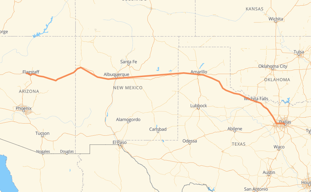
The distance from Dallas to Maine is 1,588 kilometers by road including 1,196 kilometers on motorways. Road takes approximately 15 hours and 37 minutes and goes through Irving, Amarillo, Flagstaff, Euless, Bedford, Hurst and North Richland Hills.
How much does it cost to drive from Dallas to Maine?
Fuel cost:
249 CAD
This fuel cost is calculated as: (Route length 1,588 km / 100 km) * (Fuel consumption 8 L/100 km) * (Fuel price 1.96 CAD / L)
You can adjust fuel consumption and fuel price here.
How long is a car ride from Dallas to Maine?
Driving time:
15 h 37 min
This time is calculated for driving at the maximum permitted speed, taking into account traffic rules restrictions.
1,026 km with a maximum speed 110 km/h = 9 h 19 min
69 km with a maximum speed 105 km/h = 39 min
52 km with a maximum speed 100 km/h = 31 min
31 km with a maximum speed 97 km/h = 18 min
239 km with a maximum speed 90 km/h = 2 h 39 min
3 km with a maximum speed 89 km/h = 2 min
166 km with a maximum speed 80 km/h = 2 h 4 min
2 km with a maximum speed 64 km/h = 1 min
The calculated driving time does not take into account intermediate stops and traffic jams.
How far is Dallas to Maine by land?
The distance between Dallas and Maine is 1,588 km by road including 1,196 km on motorways.
Precise satellite coordinates of highways were used for this calculation. The start and finish points are the centers of Dallas and Maine respectively.
How far is Dallas to Maine by plane?
The shortest distance (air line, as the crow flies) between Dallas and Maine is 1,421 km.
This distance is calculated using the Haversine formula as a great-circle distance between two points on the surface of a sphere. The start and finish points are the centers of Dallas and Maine respectively. Actual distance between airports may be different.
How many hours is Dallas from Maine by plane?
Boeing 737 airliner needs 1 h 46 min to cover the distance of 1,421 km at a cruising speed of 800 km/h.
Small plane "Cessna 172" needs 6 h 27 min to flight this distance at average speed of 220 km/h.
This time is approximate and do not take into account takeoff and landing times, airport location and other real world factors.
How long is a helicopter ride from Dallas to Maine?
Fast helicopter "Eurocopter AS350" or "Hughes OH-6 Cayuse" need 5 h 55 min to cover the distance of 1,421 km at a cruising speed of 240 km/h.
Popular "Robinson R44" needs 6 h 46 min to flight this distance at average speed of 210 km/h.
This time is approximate and do not take into account takeoff and landing times, aerodrome location and other real world factors.
What city is halfway between Dallas and Maine?
The halfway point between Dallas and Maine is Newkirk. It is located about 28 km from the exact midpoint by road.
The distance from Newkirk to Dallas is 822 km and driving will take about 8 h 37 min. The road between Newkirk and Maine has length 766 km and will take approximately 7 h.
The other cities located close to halfway point:
Tucumcari is in 764 km from Dallas and 824 km from Maine
Santa Rosa is in 850 km from Dallas and 738 km from Maine
San Jon is in 729 km from Dallas and 859 km from Maine
Where is Dallas in relation to Maine?
Dallas is located 1,421 km east of Maine.
Dallas has geographic coordinates: latitude 32.77626, longitude -96.79686.
Maine has geographic coordinates: latitude 35.25307, longitude -111.9385.
Which highway goes from Dallas to Maine?
The route from Dallas to Maine follows I 40, US 287, US 180.