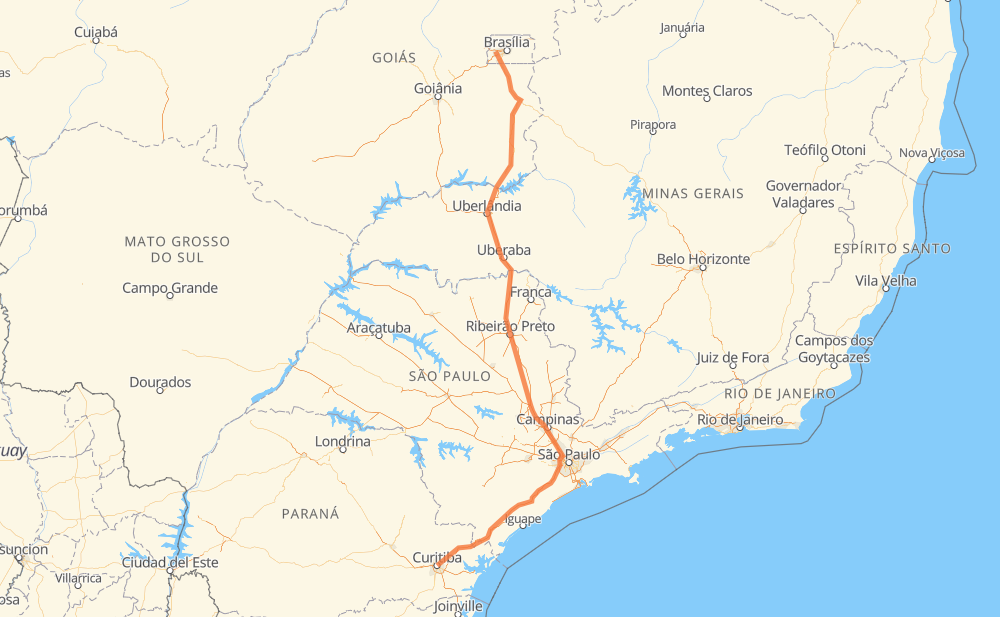
Distance between Curitiba and Ceilândia
The distance from Curitiba to Ceilândia is 1,389 kilometers by road including 1,023 kilometers on motorways. Road takes approximately 14 hours and 57 minutes and goes through Taboão da Serra, Barueri, Araras, Leme, Valparaíso de Goiás and Recanto das Emas.
| Shortest distance by air | 1,076 km ✈️ |
| Car route length | 1,389 km 🚗 |
| Driving time | 14 h 57 min |
| Fuel amount | 111.1 L |
| Fuel cost | 217.8 CAD |
| Point | Distance | Time | Fuel | |
| Curitiba | 0 km | 00 min | 0.0 L | |
|
5 km, 04 min
|
||||
| Jardim Social | 5 km | 04 min | 0.3 L | |
|
BR-476 BR-116 79 km, 1 h 02 min
|
||||
| Antonina | 84 km | 1 h 06 min | 5.3 L | |
|
BR-116 311 km, 3 h 13 min
|
||||
| Taboão da Serra | 395 km | 4 h 20 min | 31.6 L | |
|
SP-230 SP-021 18 km, 11 min
|
||||
| Barueri | 413 km | 4 h 31 min | 32.8 L | |
|
SP-021 SP-348 156 km, 1 h 32 min
|
||||
| Araras | 570 km | 6 h 04 min | 44.9 L | |
|
SP-330 20 km, 11 min
|
||||
| Leme | 589 km | 6 h 15 min | 46.5 L | |
|
SP-330 BR-050 773 km, 8 h 00 min
|
||||
| Valparaíso de Goiás | 1,362 km | 14 h 16 min | 107.8 L | |
|
BR-040 DF-001 28 km, 26 min
|
||||
| Recanto das Emas | 1,390 km | 14 h 42 min | 110.8 L | |
|
DF-001 DF-085 17 km, 15 min
|
||||
| Ceilândia | 1,407 km | 14 h 57 min | 112.4 L | |
Hotels of Ceilândia
Frequently Asked Questions
How much does it cost to drive from Curitiba to Ceilândia?
Fuel cost: 217.8 CAD
This fuel cost is calculated as: (Route length 1,389 km / 100 km) * (Fuel consumption 8 L/100 km) * (Fuel price 1.96 CAD / L)
You can adjust fuel consumption and fuel price here.
How long is a car ride from Curitiba to Ceilândia?
Driving time: 14 h 57 min
This time is calculated for driving at the maximum permitted speed, taking into account traffic rules restrictions.
- 648 km with a maximum speed 110 km/h = 5 h 53 min
- 241 km with a maximum speed 100 km/h = 2 h 24 min
- 294 km with a maximum speed 90 km/h = 3 h 16 min
- 109 km with a maximum speed 80 km/h = 1 h 21 min
- 5 km with a maximum speed 70 km/h = 3 min
- 93 km with a maximum speed 60 km/h = 1 h 33 min
- 2 km with a maximum speed 50 km/h = 1 min
- 15 km with a maximum speed 40 km/h = 22 min
The calculated driving time does not take into account intermediate stops and traffic jams.
How far is Curitiba to Ceilândia by land?
The distance between Curitiba and Ceilândia is 1,389 km by road including 1,023 km on motorways.
Precise satellite coordinates of highways were used for this calculation. The start and finish points are the centers of Curitiba and Ceilândia respectively.
How far is Curitiba to Ceilândia by plane?
The shortest distance (air line, as the crow flies) between Curitiba and Ceilândia is 1,076 km.
This distance is calculated using the Haversine formula as a great-circle distance between two points on the surface of a sphere. The start and finish points are the centers of Curitiba and Ceilândia respectively. Actual distance between airports may be different.
How many hours is Curitiba from Ceilândia by plane?
Boeing 737 airliner needs 1 h 20 min to cover the distance of 1,076 km at a cruising speed of 800 km/h.
Small plane "Cessna 172" needs 4 h 53 min to flight this distance at average speed of 220 km/h.
This time is approximate and do not take into account takeoff and landing times, airport location and other real world factors.
How long is a helicopter ride from Curitiba to Ceilândia?
Fast helicopter "Eurocopter AS350" or "Hughes OH-6 Cayuse" need 4 h 29 min to cover the distance of 1,076 km at a cruising speed of 240 km/h.
Popular "Robinson R44" needs 5 h 7 min to flight this distance at average speed of 210 km/h.
This time is approximate and do not take into account takeoff and landing times, aerodrome location and other real world factors.
What city is halfway between Curitiba and Ceilândia?
The halfway point between Curitiba and Ceilândia is Cravinhos. It is located about 2 km from the exact midpoint by road.
The distance from Cravinhos to Curitiba is 693 km and driving will take about 7 h 13 min. The road between Cravinhos and Ceilândia has length 696 km and will take approximately 7 h 44 min.
The other cities located close to halfway point:
Where is Curitiba in relation to Ceilândia?
Curitiba is located 1,076 km south of Ceilândia.
Curitiba has geographic coordinates: latitude -25.4296, longitude -49.27127.
Ceilândia has geographic coordinates: latitude -15.81734, longitude -48.10458.
Which highway goes from Curitiba to Ceilândia?
The route from Curitiba to Ceilândia follows BR-050, BR-116, SP-330, SP-230, BR-040.
Other minor sections pass along the road:
- SP-348: 71 km
- BR-478: 48 km
- SP-021: 25 km
- DF-001: 14 km
- MG-223: 14 km
- BR-262: 5 km
- SPA-102/330: 4 km
- BR-476: 4 km
- SPI-102/330: 3 km
- DF-003: 2 km
- DF-085: 2 km
- BR-267: 1 km
- SPA-330/348: 1 km