Distance between Cruz del Eje and General Levalle
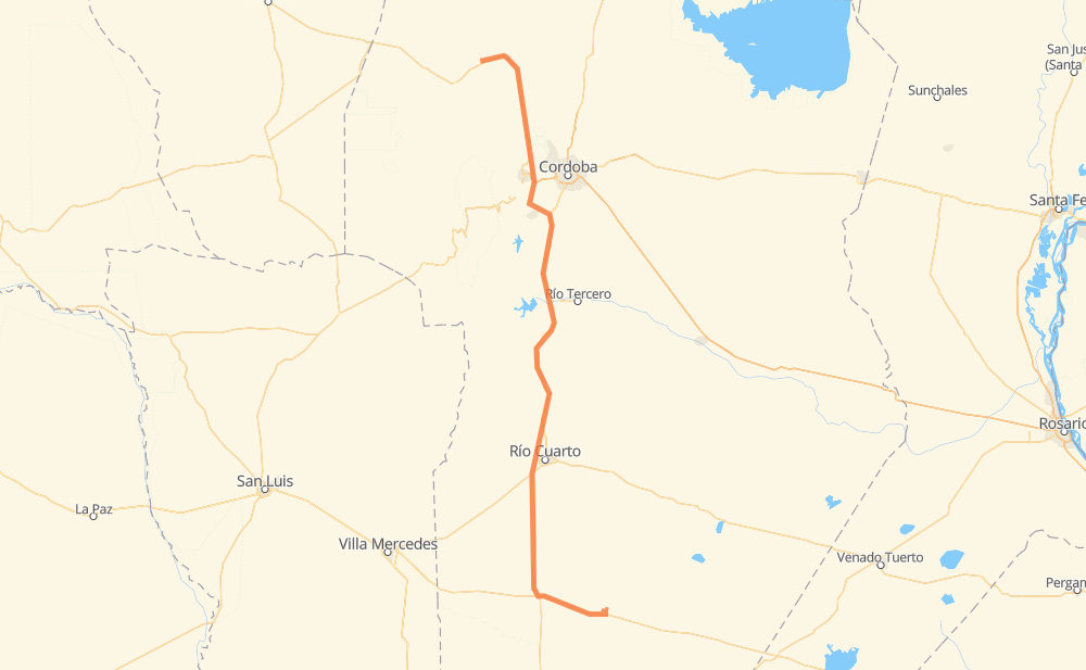
The distance from Cruz del Eje to General Levalle is 481 kilometers by road including 5 kilometers on motorways. Road takes approximately 5 hours and 37 minutes and goes through Río Cuarto, Capilla del Monte, Los Quimbaletes, La Falda, Cosquín, Santa Teresita and Comuna San Roque.
| Shortest distance by air | 375 km ✈️ |
| Car route length | 481 km 🚗 |
| Driving time | 5 h 37 min |
| Fuel amount | 38.5 L |
| Fuel cost | 75.4 CAD |
| Point | Distance | Time | Fuel | |
| Cruz del Eje | 0 km | 00 min | 0.0 L | |
|
RN38 41 km, 29 min
|
||||
| Capilla del Monte | 41 km | 29 min | 2.8 L | |
|
RN38 21 km, 14 min
|
||||
| Los Quimbaletes | 62 km | 43 min | 4.7 L | |
|
RN38 8 km, 07 min
|
||||
| La Falda | 70 km | 51 min | 5.4 L | |
|
RN38 16 km, 15 min
|
||||
| Cosquín | 86 km | 1 h 07 min | 6.4 L | |
|
RN38 18 km, 13 min
|
||||
| Comuna San Roque | 104 km | 1 h 20 min | 8.1 L | |
|
RPE55 RPC45 34 km, 22 min
|
||||
| Villa Camiares | 138 km | 1 h 43 min | 10.9 L | |
|
RPC45 RN36 200 km, 2 h 14 min
|
||||
| Río Cuarto | 337 km | 3 h 58 min | 26.2 L | |
|
RNA005 RN35 94 km, 1 h 05 min
|
||||
| Vicuña Mackenna | 432 km | 5 h 03 min | 31.0 L | |
|
RN7 49 km, 33 min
|
||||
| General Levalle | 481 km | 5 h 37 min | 38.2 L | |
Frequently Asked Questions
How much does it cost to drive from Cruz del Eje to General Levalle?
Fuel cost: 75.4 CAD
This fuel cost is calculated as: (Route length 481 km / 100 km) * (Fuel consumption 8 L/100 km) * (Fuel price 1.96 CAD / L)
You can adjust fuel consumption and fuel price here.
How long is a car ride from Cruz del Eje to General Levalle?
Driving time: 5 h 37 min
This time is calculated for driving at the maximum permitted speed, taking into account traffic rules restrictions.
- 5 km with a maximum speed 110 km/h = 2 min
- 392 km with a maximum speed 90 km/h = 4 h 21 min
- 46 km with a maximum speed 80 km/h = 34 min
- 34 km with a maximum speed 60 km/h = 34 min
- 1 km with a maximum speed 50 km/h = 1 min
- 2 km with a maximum speed 40 km/h = 3 min
The calculated driving time does not take into account intermediate stops and traffic jams.
How far is Cruz del Eje to General Levalle by land?
The distance between Cruz del Eje and General Levalle is 481 km by road including 5 km on motorways.
Precise satellite coordinates of highways were used for this calculation. The start and finish points are the centers of Cruz del Eje and General Levalle respectively.
How far is Cruz del Eje to General Levalle by plane?
The shortest distance (air line, as the crow flies) between Cruz del Eje and General Levalle is 375 km.
This distance is calculated using the Haversine formula as a great-circle distance between two points on the surface of a sphere. The start and finish points are the centers of Cruz del Eje and General Levalle respectively. Actual distance between airports may be different.
How many hours is Cruz del Eje from General Levalle by plane?
Boeing 737 airliner needs 28 min to cover the distance of 375 km at a cruising speed of 800 km/h.
Small plane "Cessna 172" needs 1 h 42 min to flight this distance at average speed of 220 km/h.
This time is approximate and do not take into account takeoff and landing times, airport location and other real world factors.
How long is a helicopter ride from Cruz del Eje to General Levalle?
Fast helicopter "Eurocopter AS350" or "Hughes OH-6 Cayuse" need 1 h 33 min to cover the distance of 375 km at a cruising speed of 240 km/h.
Popular "Robinson R44" needs 1 h 47 min to flight this distance at average speed of 210 km/h.
This time is approximate and do not take into account takeoff and landing times, aerodrome location and other real world factors.
What city is halfway between Cruz del Eje and General Levalle?
The halfway point between Cruz del Eje and General Levalle is Los Cóndores. It is located about 12 km from the exact midpoint by road.
The distance from Los Cóndores to Cruz del Eje is 228 km and driving will take about 2 h 44 min. The road between Los Cóndores and General Levalle has length 253 km and will take approximately 2 h 53 min.
The other cities located close to halfway point:
Where is Cruz del Eje in relation to General Levalle?
Cruz del Eje is located 375 km north-west of General Levalle.
Cruz del Eje has geographic coordinates: latitude -30.72193, longitude -64.80868.
General Levalle has geographic coordinates: latitude -34.0075, longitude -63.92339.
Which highway goes from Cruz del Eje to General Levalle?
The route from Cruz del Eje to General Levalle follows RN36.
Other minor sections pass along the road:
- RN38: 96 km
- RN35: 82 km
- RN7: 46 km
- RPC45: 33 km
- RNA005: 11 km
- RN20: 9 km
- RN8: 8 km
- RPE55: 5 km
- RP10: 4 km
- RP5: 2 km