Distance between Ciudad Mier and Vista Hermosa
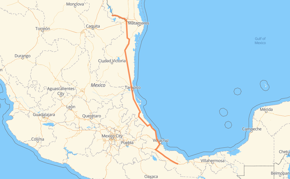
The distance from Ciudad Mier to Vista Hermosa is 1,303 kilometers by road including 362 kilometers on motorways. Road takes approximately 15 hours and 3 minutes and goes through McAllen, Reynosa, Aldama and Ciudad Madero.
| Shortest distance by air | 1,035 km ✈️ |
| Car route length | 1,303 km 🚗 |
| Driving time | 15 h 3 min |
| Fuel amount | 104.2 L |
| Fuel cost | 204.3 CAD |
| Toll roads cost | 952 + ? MXN |
| Point | Distance | Time | Fuel | |
| Ciudad Mier | 0 km | 00 min | 0.0 L | |
|
MEX 2 US 83 36 km, 28 min
|
||||
| Rio Grande City | 36 km | 28 min | 2.2 L | |
|
US 83 50 km, 36 min
|
||||
| Palmview | 86 km | 1 h 04 min | 6.6 L | |
|
I 2 10 km, 06 min
|
||||
| Mission | 95 km | 1 h 10 min | 7.1 L | |
|
I 2 10 km, 07 min
|
||||
| McAllen | 106 km | 1 h 18 min | 8.1 L | |
|
Spur 115 5 km, 03 min
|
||||
| Hidalgo | 110 km | 1 h 21 min | 8.8 L | |
|
US 281 3 km, 01 min
|
||||
| Reynosa | 113 km | 1 h 23 min | 8.9 L | |
|
MEX 180 397 km, 4 h 34 min
|
||||
| Aldama | 510 km | 5 h 58 min | 39.6 L | |
|
MEX 180 TAM 113 109 km, 1 h 18 min
|
||||
| Ciudad Madero | 619 km | 7 h 16 min | 49.2 L | |
|
MEX 180 692 km, 7 h 46 min
|
||||
| Vista Hermosa | 1,311 km | 15 h 02 min | 104.7 L | |
Frequently Asked Questions
How many toll booths are there from Ciudad Mier to Vista Hermosa?
There are 10 toll booths between Ciudad Mier and Vista Hermosa: Puente Internacional Miguel Alemán, Tampico, Naranjos, Tuxpan, Cardel - Posa Rica, Nautla, La Antigua, San Julián, Paso del Toro and Cosamaloapan.
How much does the toll booths cost from Ciudad Mier to Vista Hermosa?
Toll roads cost: Puente Internacional Miguel Alemán (30 MXN) + Tampico (35 MXN) + Naranjos (297 MXN) + Tuxpan (45 MXN) + Cardel - Posa Rica (205 MXN) + Nautla (24 MXN) + La Antigua (?) + San Julián (?) + Paso del Toro (87 MXN) + Cosamaloapan (229 MXN) = 952 + ? MXN
How much does it cost to drive from Ciudad Mier to Vista Hermosa?
Fuel cost: 204.3 CAD
This fuel cost is calculated as: (Route length 1,303 km / 100 km) * (Fuel consumption 8 L/100 km) * (Fuel price 1.96 CAD / L)
You can adjust fuel consumption and fuel price here.
Toll roads cost: 952 + ? MXN
How long is a car ride from Ciudad Mier to Vista Hermosa?
Driving time: 15 h 3 min
This time is calculated for driving at the maximum permitted speed, taking into account traffic rules restrictions.
- 18 km with a maximum speed 110 km/h = 10 min
- 10 km with a maximum speed 105 km/h = 5 min
- 264 km with a maximum speed 100 km/h = 2 h 38 min
- 486 km with a maximum speed 90 km/h = 5 h 24 min
- 6 km with a maximum speed 89 km/h = 3 min
- 513 km with a maximum speed 80 km/h = 6 h 24 min
- 3 km with a maximum speed 60 km/h = 2 min
- 7 km with a maximum speed 50 km/h = 8 min
- 2 km with a maximum speed 40 km/h = 3 min
The calculated driving time does not take into account intermediate stops and traffic jams.
How far is Ciudad Mier to Vista Hermosa by land?
The distance between Ciudad Mier and Vista Hermosa is 1,303 km by road including 362 km on motorways.
Precise satellite coordinates of highways were used for this calculation. The start and finish points are the centers of Ciudad Mier and Vista Hermosa respectively.
How far is Ciudad Mier to Vista Hermosa by plane?
The shortest distance (air line, as the crow flies) between Ciudad Mier and Vista Hermosa is 1,035 km.
This distance is calculated using the Haversine formula as a great-circle distance between two points on the surface of a sphere. The start and finish points are the centers of Ciudad Mier and Vista Hermosa respectively. Actual distance between airports may be different.
How many hours is Ciudad Mier from Vista Hermosa by plane?
Boeing 737 airliner needs 1 h 17 min to cover the distance of 1,035 km at a cruising speed of 800 km/h.
Small plane "Cessna 172" needs 4 h 42 min to flight this distance at average speed of 220 km/h.
This time is approximate and do not take into account takeoff and landing times, airport location and other real world factors.
How long is a helicopter ride from Ciudad Mier to Vista Hermosa?
Fast helicopter "Eurocopter AS350" or "Hughes OH-6 Cayuse" need 4 h 18 min to cover the distance of 1,035 km at a cruising speed of 240 km/h.
Popular "Robinson R44" needs 4 h 55 min to flight this distance at average speed of 210 km/h.
This time is approximate and do not take into account takeoff and landing times, aerodrome location and other real world factors.
What city is halfway between Ciudad Mier and Vista Hermosa?
The halfway point between Ciudad Mier and Vista Hermosa is Tampico Alto. It is located about 9 km from the exact midpoint by road.
The distance from Tampico Alto to Ciudad Mier is 643 km and driving will take about 7 h 34 min. The road between Tampico Alto and Vista Hermosa has length 660 km and will take approximately 7 h 28 min.
The other cities located close to halfway point:
Where is Ciudad Mier in relation to Vista Hermosa?
Ciudad Mier is located 1,035 km north-west of Vista Hermosa.
Ciudad Mier has geographic coordinates: latitude 26.43064, longitude -99.1482.
Vista Hermosa has geographic coordinates: latitude 17.92556, longitude -95.06.
Which highway goes from Ciudad Mier to Vista Hermosa?
The route from Ciudad Mier to Vista Hermosa follows MEX 180, MEX 145D, MEX 180D, MEX 97.
Other minor sections pass along the road:
- MEX 101: 79 km
- US 83: 76 km
- TAM 113: 58 km
- MEX 135D: 45 km
- MEX 150D: 43 km
- MEX: 30 km
- MEX 129: 23 km
- MEX 80: 18 km
- MEX 2: 15 km
- MEX 132D: 13 km
- I 2: 11 km
- MEX 132: 10 km
- FM 1016: 6 km
- Spur 115: 4 km
- FM 396: 4 km
- FM 755: 2 km
- US 281: 1 km