Distance between Challis ID and Dodge City KS
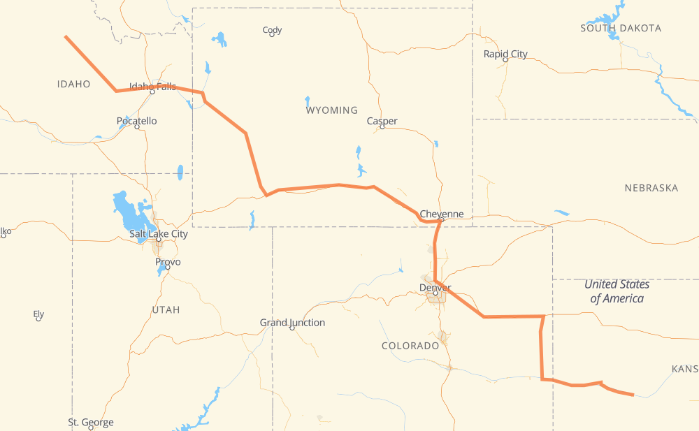
The distance from Challis to Dodge City is 1,842 kilometers by road including 828 kilometers on motorways. Road takes approximately 19 hours and 8 minutes and goes through Idaho Falls, Jackson, Rock Springs, Laramie, Cheyenne and Denver.
| Shortest distance by air | 1,405 km ✈️ |
| Car route length | 1,842 km 🚗 |
| Driving time | 19 h 8 min |
| Fuel amount | 147.4 L |
| Fuel cost | 288.8 CAD |
| Point | Distance | Time | Fuel | |
| Challis | 0 km | 00 min | 0.0 L | |
|
US 93 132 km, 1 h 32 min
|
||||
| Arco | 132 km | 1 h 32 min | 10.3 L | |
|
US 26 US 20 105 km, 1 h 11 min
|
||||
| Idaho Falls | 238 km | 2 h 43 min | 18.6 L | |
|
US 20 US 26 141 km, 1 h 38 min
|
||||
| Jackson | 379 km | 4 h 22 min | 30.3 L | |
|
US 26 US 191 120 km, 1 h 21 min
|
||||
| Pinedale | 499 km | 5 h 43 min | 39.8 L | |
|
US 191 152 km, 1 h 42 min
|
||||
| Rock Springs | 651 km | 7 h 26 min | 51.2 L | |
|
US 191 I 80 341 km, 3 h 07 min
|
||||
| Laramie | 992 km | 10 h 33 min | 78.8 L | |
|
I 80 75 km, 41 min
|
||||
| Cheyenne | 1,067 km | 11 h 14 min | 85.2 L | |
|
US 87 I 25 156 km, 1 h 25 min
|
||||
| Denver | 1,223 km | 12 h 40 min | 97.6 L | |
|
E-470 I 70 619 km, 6 h 27 min
|
||||
| Dodge City | 1,842 km | 19 h 07 min | 147.1 L | |
Hotels of Dodge City
Frequently Asked Questions
How much does it cost to drive from Challis to Dodge City?
Fuel cost: 288.8 CAD
This fuel cost is calculated as: (Route length 1,842 km / 100 km) * (Fuel consumption 8 L/100 km) * (Fuel price 1.96 CAD / L)
You can adjust fuel consumption and fuel price here.
How long is a car ride from Challis to Dodge City?
Driving time: 19 h 8 min
This time is calculated for driving at the maximum permitted speed, taking into account traffic rules restrictions.
- 816 km with a maximum speed 110 km/h = 7 h 25 min
- 2 km with a maximum speed 105 km/h = 1 min
- 3 km with a maximum speed 100 km/h = 1 min
- 811 km with a maximum speed 90 km/h = 9 h
- 111 km with a maximum speed 89 km/h = 1 h 15 min
- 4 km with a maximum speed 80 km/h = 2 min
- 53 km with a maximum speed 80 km/h = 39 min
- 17 km with a maximum speed 72 km/h = 13 min
- 9 km with a maximum speed 64 km/h = 8 min
- 7 km with a maximum speed 56 km/h = 7 min
- 2 km with a maximum speed 50 km/h = 2 min
- 5 km with a maximum speed 48 km/h = 5 min
- 2 km with a maximum speed 40 km/h = 2 min
The calculated driving time does not take into account intermediate stops and traffic jams.
How far is Challis to Dodge City by land?
The distance between Challis and Dodge City is 1,842 km by road including 828 km on motorways.
Precise satellite coordinates of highways were used for this calculation. The start and finish points are the centers of Challis and Dodge City respectively.
How far is Challis to Dodge City by plane?
The shortest distance (air line, as the crow flies) between Challis and Dodge City is 1,405 km.
This distance is calculated using the Haversine formula as a great-circle distance between two points on the surface of a sphere. The start and finish points are the centers of Challis and Dodge City respectively. Actual distance between airports may be different.
How many hours is Challis from Dodge City by plane?
Boeing 737 airliner needs 1 h 45 min to cover the distance of 1,405 km at a cruising speed of 800 km/h.
Small plane "Cessna 172" needs 6 h 23 min to flight this distance at average speed of 220 km/h.
This time is approximate and do not take into account takeoff and landing times, airport location and other real world factors.
How long is a helicopter ride from Challis to Dodge City?
Fast helicopter "Eurocopter AS350" or "Hughes OH-6 Cayuse" need 5 h 51 min to cover the distance of 1,405 km at a cruising speed of 240 km/h.
Popular "Robinson R44" needs 6 h 41 min to flight this distance at average speed of 210 km/h.
This time is approximate and do not take into account takeoff and landing times, aerodrome location and other real world factors.
What city is halfway between Challis and Dodge City?
The halfway point between Challis and Dodge City is Laramie. It is located about 71 km from the exact midpoint by road.
The distance from Laramie to Challis is 992 km and driving will take about 10 h 33 min. The road between Laramie and Dodge City has length 850 km and will take approximately 8 h 34 min.
The other cities located close to halfway point:
Where is Challis in relation to Dodge City?
Challis is located 1,405 km north-west of Dodge City.
Challis has geographic coordinates: latitude 44.50464, longitude -114.23173.
Dodge City has geographic coordinates: latitude 37.7528, longitude -100.01708.
Which highway goes from Challis to Dodge City?
The route from Challis to Dodge City follows I 80, US 191, US 30, I 70, US 50, US 400, US 385, US 93, I 25, US 26, US 20, US 189.
Other minor sections pass along the road:
- E-470: 40 km
- WY 789: 38 km
- ID 31: 33 km
- US 287: 30 km
- WY 22: 28 km
- CR 45: 23 km
- US 89: 19 km
- CR 66: 18 km
- US 87: 14 km
- CR 24.5: 12 km
- ID 33: 9 km
- US 83: 8 km
- CO 96: 1 km