Distance between Ceilândia and Guriri
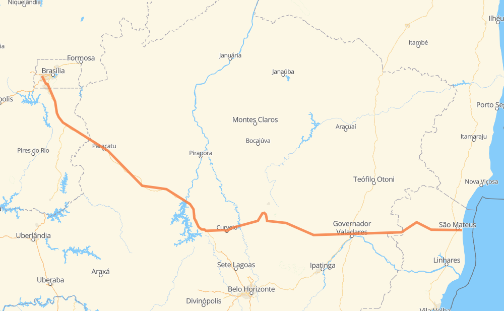
The distance from Ceilândia to Guriri is 1,283 kilometers by road. Road takes approximately 16 hours and 55 minutes and goes through Recanto das Emas, Valparaíso de Goiás, Ceilândia Centro, Setor de Mansões de Samambaia - SMSE - Setor de Mansões Sudeste, CAUB 2, Área Alfa and Parque Jardim São Paulo.
| Shortest distance by air | 944 km ✈️ |
| Car route length | 1,283 km 🚗 |
| Driving time | 16 h 55 min |
| Fuel amount | 102.6 L |
| Fuel cost | 201.1 CAD |
| Point | Distance | Time | Fuel | |
| Ceilândia | 0 km | 00 min | 0.0 L | |
|
DF-085 10 km, 09 min
|
||||
| Setor de Mansões de Samambaia - SMSE - Setor de Mansões Sudeste | 10 km | 09 min | 0.6 L | |
|
7 km, 05 min
|
||||
| Recanto das Emas | 17 km | 15 min | 0.9 L | |
|
DF-001 9 km, 06 min
|
||||
| Área Alfa | 25 km | 22 min | 1.8 L | |
|
DF-001 BR-040 19 km, 18 min
|
||||
| Valparaíso de Goiás | 45 km | 40 min | 2.4 L | |
|
BR-040 23 km, 20 min
|
||||
| Parque Jardim São Paulo | 68 km | 1 h 01 min | 4.8 L | |
|
BR-040 265 km, 3 h 00 min
|
||||
| João Pinheiro | 333 km | 4 h 01 min | 25.1 L | |
|
BR-040 246 km, 2 h 48 min
|
||||
| Curvelo | 580 km | 6 h 50 min | 44.3 L | |
|
BR-259 63 km, 45 min
|
||||
| Vila Alexandre Mascarenhas | 643 km | 7 h 35 min | 51.4 L | |
|
BR-259 671 km, 9 h 19 min
|
||||
| Guriri | 1,314 km | 16 h 55 min | 105.0 L | |
Frequently Asked Questions
How much does it cost to drive from Ceilândia to Guriri?
Fuel cost: 201.1 CAD
This fuel cost is calculated as: (Route length 1,283 km / 100 km) * (Fuel consumption 8 L/100 km) * (Fuel price 1.96 CAD / L)
You can adjust fuel consumption and fuel price here.
How long is a car ride from Ceilândia to Guriri?
Driving time: 16 h 55 min
This time is calculated for driving at the maximum permitted speed, taking into account traffic rules restrictions.
- 672 km with a maximum speed 90 km/h = 7 h 27 min
- 498 km with a maximum speed 80 km/h = 6 h 13 min
- 45 km with a maximum speed 60 km/h = 45 min
- 1 km with a maximum speed 50 km/h = 1 min
- 98 km with a maximum speed 40 km/h = 2 h 26 min
- 1 km with a maximum speed 30 km/h = 1 min
The calculated driving time does not take into account intermediate stops and traffic jams.
How far is Ceilândia to Guriri by land?
The distance between Ceilândia and Guriri is 1,283 km by road.
Precise satellite coordinates of highways were used for this calculation. The start and finish points are the centers of Ceilândia and Guriri respectively.
How far is Ceilândia to Guriri by plane?
The shortest distance (air line, as the crow flies) between Ceilândia and Guriri is 944 km.
This distance is calculated using the Haversine formula as a great-circle distance between two points on the surface of a sphere. The start and finish points are the centers of Ceilândia and Guriri respectively. Actual distance between airports may be different.
How many hours is Ceilândia from Guriri by plane?
Boeing 737 airliner needs 1 h 10 min to cover the distance of 944 km at a cruising speed of 800 km/h.
Small plane "Cessna 172" needs 4 h 17 min to flight this distance at average speed of 220 km/h.
This time is approximate and do not take into account takeoff and landing times, airport location and other real world factors.
How long is a helicopter ride from Ceilândia to Guriri?
Fast helicopter "Eurocopter AS350" or "Hughes OH-6 Cayuse" need 3 h 56 min to cover the distance of 944 km at a cruising speed of 240 km/h.
Popular "Robinson R44" needs 4 h 29 min to flight this distance at average speed of 210 km/h.
This time is approximate and do not take into account takeoff and landing times, aerodrome location and other real world factors.
What city is halfway between Ceilândia and Guriri?
The halfway point between Ceilândia and Guriri is Vila Alexandre Mascarenhas. It is located about 1 km from the exact midpoint by road.
The distance from Vila Alexandre Mascarenhas to Ceilândia is 643 km and driving will take about 7 h 35 min. The road between Vila Alexandre Mascarenhas and Guriri has length 640 km and will take approximately 9 h 20 min.
The other cities located close to halfway point:
Where is Ceilândia in relation to Guriri?
Ceilândia is located 944 km north-west of Guriri.
Ceilândia has geographic coordinates: latitude -15.81734, longitude -48.10458.
Guriri has geographic coordinates: latitude -18.74159, longitude -39.75906.
Which highway goes from Ceilândia to Guriri?
The route from Ceilândia to Guriri follows BR-040, BR-259, MGC-259, BR-381.
Other minor sections pass along the road:
- BR-050: 85 km
- ES-381: 64 km
- ES-220: 37 km
- BR-342: 22 km
- ES-320: 17 km
- DF-001: 14 km
- MGC-381: 12 km
- CMG-259: 10 km
- BR-367: 7 km
- MGC-367: 7 km
- ES-315: 5 km
- BR-116: 3 km
- ES-010: 3 km
- DF-003: 2 km
- DF-085: 2 km
- ES-080: 2 km
- BR-101: 2 km
- ES-137: 2 km