Distance between Carlos Chagas and São Miguel Arcanjo
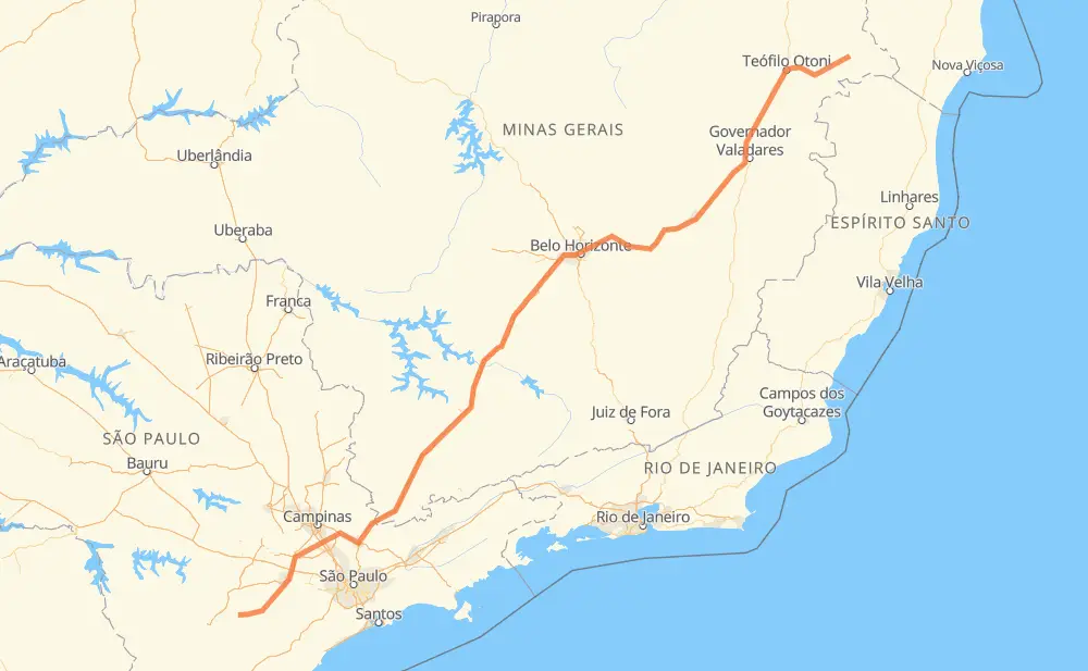
The distance from Carlos Chagas to São Miguel Arcanjo is 1,301 kilometers by road including 639 kilometers on motorways. Road takes approximately 14 hours and 57 minutes and goes through Teófilo Otoni, Coronel Fabriciano, Contagem, Betim, Atibaia, Itatiba and Itu.
| Shortest distance by air | 1,018 km ✈️ |
| Car route length | 1,301 km 🚗 |
| Driving time | 14 h 57 min |
| Fuel amount | 104.1 L |
| Fuel cost | 204 CAD |
| Point | Distance | Time | Fuel | |
| Carlos Chagas | 0 km | 00 min | 0.0 L | |
|
BR-418 110 km, 1 h 24 min
|
||||
| Teófilo Otoni | 110 km | 1 h 24 min | 8.7 L | |
|
BR-116 31 km, 30 min
|
||||
| Itambacuri | 141 km | 1 h 54 min | 10.8 L | |
|
BR-116 BR-381 217 km, 2 h 36 min
|
||||
| Coronel Fabriciano | 358 km | 4 h 30 min | 28.4 L | |
|
BR-381 220 km, 2 h 54 min
|
||||
| Contagem | 578 km | 7 h 25 min | 45.9 L | |
|
BR-381 16 km, 10 min
|
||||
| Betim | 594 km | 7 h 36 min | 47.1 L | |
|
BR-381 491 km, 4 h 51 min
|
||||
| Atibaia | 1,085 km | 12 h 28 min | 85.7 L | |
|
SP-065 30 km, 18 min
|
||||
| Itatiba | 1,115 km | 12 h 46 min | 88.5 L | |
|
SP-063 SP-300 68 km, 44 min
|
||||
| Itu | 1,182 km | 13 h 30 min | 94.3 L | |
|
SP-300 SP-075 41 km, 25 min
|
||||
| Votorantim | 1,223 km | 13 h 56 min | 97.4 L | |
|
SP-270 SP-264 82 km, 1 h 00 min
|
||||
| -23.88078, -47.99635 | 1,305 km | 14 h 56 min | 104.4 L | |
Frequently Asked Questions
How much does it cost to drive from Carlos Chagas to São Miguel Arcanjo?
Fuel cost: 204 CAD
This fuel cost is calculated as: (Route length 1,301 km / 100 km) * (Fuel consumption 8 L/100 km) * (Fuel price 1.96 CAD / L)
You can adjust fuel consumption and fuel price here.
How long is a car ride from Carlos Chagas to São Miguel Arcanjo?
Driving time: 14 h 57 min
This time is calculated for driving at the maximum permitted speed, taking into account traffic rules restrictions.
- 372 km with a maximum speed 110 km/h = 3 h 22 min
- 137 km with a maximum speed 100 km/h = 1 h 22 min
- 256 km with a maximum speed 90 km/h = 2 h 50 min
- 439 km with a maximum speed 80 km/h = 5 h 28 min
- 7 km with a maximum speed 70 km/h = 5 min
- 69 km with a maximum speed 60 km/h = 1 h 8 min
- 3 km with a maximum speed 50 km/h = 3 min
- 23 km with a maximum speed 40 km/h = 33 min
The calculated driving time does not take into account intermediate stops and traffic jams.
How far is Carlos Chagas to São Miguel Arcanjo by land?
The distance between Carlos Chagas and São Miguel Arcanjo is 1,301 km by road including 639 km on motorways.
Precise satellite coordinates of highways were used for this calculation. The start and finish points are the centers of Carlos Chagas and São Miguel Arcanjo respectively.
How far is Carlos Chagas to São Miguel Arcanjo by plane?
The shortest distance (air line, as the crow flies) between Carlos Chagas and São Miguel Arcanjo is 1,018 km.
This distance is calculated using the Haversine formula as a great-circle distance between two points on the surface of a sphere. The start and finish points are the centers of Carlos Chagas and São Miguel Arcanjo respectively. Actual distance between airports may be different.
How many hours is Carlos Chagas from São Miguel Arcanjo by plane?
Boeing 737 airliner needs 1 h 16 min to cover the distance of 1,018 km at a cruising speed of 800 km/h.
Small plane "Cessna 172" needs 4 h 37 min to flight this distance at average speed of 220 km/h.
This time is approximate and do not take into account takeoff and landing times, airport location and other real world factors.
How long is a helicopter ride from Carlos Chagas to São Miguel Arcanjo?
Fast helicopter "Eurocopter AS350" or "Hughes OH-6 Cayuse" need 4 h 14 min to cover the distance of 1,018 km at a cruising speed of 240 km/h.
Popular "Robinson R44" needs 4 h 50 min to flight this distance at average speed of 210 km/h.
This time is approximate and do not take into account takeoff and landing times, aerodrome location and other real world factors.
What city is halfway between Carlos Chagas and São Miguel Arcanjo?
The halfway point between Carlos Chagas and São Miguel Arcanjo is Itaguara. It is located about 7 km from the exact midpoint by road.
The distance from Itaguara to Carlos Chagas is 658 km and driving will take about 8 h 18 min. The road between Itaguara and São Miguel Arcanjo has length 643 km and will take approximately 6 h 38 min.
The other cities located close to halfway point:
Where is Carlos Chagas in relation to São Miguel Arcanjo?
Carlos Chagas is located 1,018 km north-east of São Miguel Arcanjo.
Carlos Chagas has geographic coordinates: latitude -17.70308, longitude -40.76329.
São Miguel Arcanjo has geographic coordinates: latitude -23.88078, longitude -47.99635.
Which highway goes from Carlos Chagas to São Miguel Arcanjo?
The route from Carlos Chagas to São Miguel Arcanjo follows BR-381, BR-116, BR-418.
Other minor sections pass along the road:
- SP-300: 46 km
- SP-010: 36 km
- SP-264: 34 km
- MGC-418: 30 km
- SP-250: 30 km
- SP-065: 27 km
- SP-075: 23 km
- BR-262: 20 km
- SP-360: 20 km
- SP-270: 12 km
- BR-272: 10 km
- SP-063: 9 km
- SPI 091/270: 6 km
- LMG-776: 4 km
- BR-494: 3 km
- MG-105: 2 km
- BR-342: 2 km
- MG-434: 2 km
- MG-129: 1 km