Distance between Cancún and Colotlán
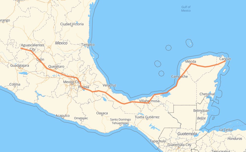
The distance from Cancún to Colotlán is 2,298 kilometers by road including 1,400 kilometers on motorways. Road takes approximately 25 hours and 7 minutes and goes through Kanasín, Mérida, Orizaba, Celaya and Salamanca.
| Shortest distance by air | 1,702 km ✈️ |
| Car route length | 2,298 km 🚗 |
| Driving time | 25 h 7 min |
| Fuel amount | 183.9 L |
| Fuel cost | 364 CAD |
| Toll roads cost | 1,487 + ? MXN |
| Point | Distance | Time | Fuel | |
| Cancún | 0 km | 00 min | 0.0 L | |
|
MEX 180 MEX 180D 253 km, 2 h 45 min
|
||||
| Hoctún | 253 km | 2 h 45 min | 19.5 L | |
|
MEX 180 15 km, 10 min
|
||||
| Tahmek | 268 km | 2 h 56 min | 21.3 L | |
|
MEX 180 31 km, 23 min
|
||||
| Kanasín | 299 km | 3 h 20 min | 23.6 L | |
|
MEX 180 11 km, 07 min
|
||||
| Mérida | 310 km | 3 h 27 min | 24.2 L | |
|
MEX 180 32 km, 21 min
|
||||
| Chocholá | 342 km | 3 h 49 min | 27.2 L | |
|
MEX 180 1,004 km, 11 h 06 min
|
||||
| Orizaba | 1,346 km | 14 h 55 min | 107.4 L | |
|
MEX 150D 514 km, 5 h 24 min
|
||||
| Celaya | 1,860 km | 20 h 20 min | 148.7 L | |
|
MEX 45D 34 km, 20 min
|
||||
| Salamanca | 1,895 km | 20 h 40 min | 151.6 L | |
|
MEX 45D MEX 70 407 km, 4 h 27 min
|
||||
| Colotlán | 2,302 km | 25 h 07 min | 182.4 L | |
Frequently Asked Questions
How many toll booths are there from Cancún to Colotlán?
There are 25 toll booths between Cancún and Colotlán: Fortín, Cuitláhuac, Cosamaloapan, Acayucan, Antonio Dovali, Encarnacion De Diaz, León - Aguascalientes, Puerto Interior, Mendoza, Cerro Gordo, Apaseo el Grande, Queretaro, Palmillas, San Martin Texmelucan, San Martín, Amozoc 2, Amozoc, Esperanza 27, Sánchez Magallanes, Villahermosa Nacajuca, Zacatal, Unidad, Seybaplaya, Pisté and El Tintal.
How much does the toll booths cost from Cancún to Colotlán?
Toll roads cost: El Tintal (?) + Pisté (?) + Seybaplaya (77 MXN) + Unidad (?) + Zacatal (90 MXN) + Villahermosa Nacajuca (62 MXN) + Sánchez Magallanes (82 MXN) + Antonio Dovali (20 MXN) + Acayucan (?) + Cosamaloapan (229 MXN) + Cuitláhuac (114 MXN) + Fortín (33 MXN) + Esperanza 27 (140 MXN) + Amozoc (72 MXN) + Amozoc 2 (81 MXN) + San Martín (42 MXN) + San Martin Texmelucan (?) + Queretaro (?) + Palmillas (89 MXN) + Apaseo el Grande (?) + Cerro Gordo (?) + Mendoza (53 MXN) + Puerto Interior (?) + León - Aguascalientes (153 MXN) + Encarnacion De Diaz (150 MXN) = 1,487 + ? MXN
How much does it cost to drive from Cancún to Colotlán?
Fuel cost: 364 CAD
This fuel cost is calculated as: (Route length 2,298 km / 100 km) * (Fuel consumption 8 L/100 km) * (Fuel price 1.98 CAD / L)
You can adjust fuel consumption and fuel price here.
Toll roads cost: 1,487 + ? MXN
How long is a car ride from Cancún to Colotlán?
Driving time: 25 h 7 min
This time is calculated for driving at the maximum permitted speed, taking into account traffic rules restrictions.
- 510 km with a maximum speed 110 km/h = 4 h 38 min
- 578 km with a maximum speed 100 km/h = 5 h 46 min
- 420 km with a maximum speed 90 km/h = 4 h 39 min
- 773 km with a maximum speed 80 km/h = 9 h 39 min
- 4 km with a maximum speed 70 km/h = 3 min
- 13 km with a maximum speed 60 km/h = 12 min
- 2 km with a maximum speed 50 km/h = 2 min
- 3 km with a maximum speed 40 km/h = 4 min
The calculated driving time does not take into account intermediate stops and traffic jams.
How far is Cancún to Colotlán by land?
The distance between Cancún and Colotlán is 2,298 km by road including 1,400 km on motorways.
Precise satellite coordinates of highways were used for this calculation. The start and finish points are the centers of Cancún and Colotlán respectively.
How far is Cancún to Colotlán by plane?
The shortest distance (air line, as the crow flies) between Cancún and Colotlán is 1,702 km.
This distance is calculated using the Haversine formula as a great-circle distance between two points on the surface of a sphere. The start and finish points are the centers of Cancún and Colotlán respectively. Actual distance between airports may be different.
How many hours is Cancún from Colotlán by plane?
Boeing 737 airliner needs 2 h 7 min to cover the distance of 1,702 km at a cruising speed of 800 km/h.
Small plane "Cessna 172" needs 7 h 44 min to flight this distance at average speed of 220 km/h.
This time is approximate and do not take into account takeoff and landing times, airport location and other real world factors.
How long is a helicopter ride from Cancún to Colotlán?
Fast helicopter "Eurocopter AS350" or "Hughes OH-6 Cayuse" need 7 h 5 min to cover the distance of 1,702 km at a cruising speed of 240 km/h.
Popular "Robinson R44" needs 8 h 6 min to flight this distance at average speed of 210 km/h.
This time is approximate and do not take into account takeoff and landing times, aerodrome location and other real world factors.
What city is halfway between Cancún and Colotlán?
The halfway point between Cancún and Colotlán is Pichoapa. It is located about 38 km from the exact midpoint by road.
The distance from Pichoapa to Cancún is 1,187 km and driving will take about 13 h 20 min. The road between Pichoapa and Colotlán has length 1,111 km and will take approximately 11 h 47 min.
The other cities located close to halfway point:
Where is Cancún in relation to Colotlán?
Cancún is located 1,702 km east of Colotlán.
Cancún has geographic coordinates: latitude 21.16183, longitude -86.82505.
Colotlán has geographic coordinates: latitude 22.11184, longitude -103.26683.
Which highway goes from Cancún to Colotlán?
The route from Cancún to Colotlán follows MEX 180, MEX 180D, MEX 150D, MEX 145D, MEX M40D, MEX 45D, MEX 70.
Other minor sections pass along the road:
- MEX 47D: 84 km
- MEX 43D: 77 km
- MEX 57D: 56 km
- MEX 45: 40 km
- MEX 23: 39 km
- MEX 54: 12 km
- MEX 23 Truck: 3 km
- MEX 140D: 2 km