Distance between Calgary AB and Jackson MI
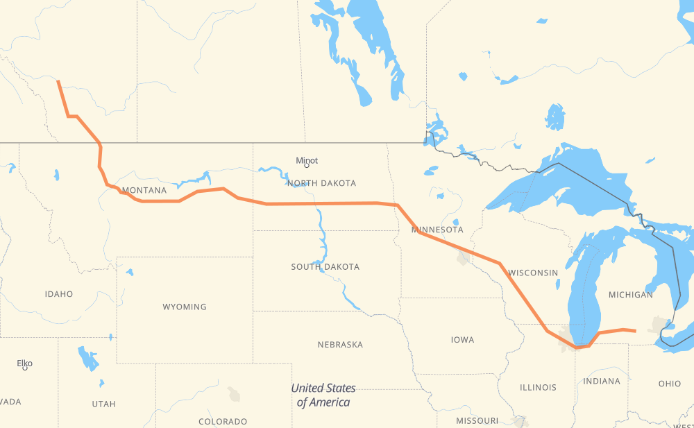
The distance from Calgary to Jackson is 3,055 kilometers by road including 2,241 kilometers on motorways. Road takes approximately 30 hours and 40 minutes and goes through Lethbridge, Great Falls, Dickinson, Mandan, Bismarck, West Fargo and Fargo.
| Shortest distance by air | 2,446 km ✈️ |
| Car route length | 3,055 km 🚗 |
| Driving time | 30 h 40 min |
| Fuel amount | 244.4 L |
| Fuel cost | 479 CAD |
| Point | Distance | Time | Fuel | |
| Calgary | 0 km | 00 min | 0.0 L | |
|
2 209 km, 2 h 17 min
|
||||
| Lethbridge | 209 km | 2 h 17 min | 16.5 L | |
|
3 I 15 301 km, 3 h 22 min
|
||||
| Great Falls | 510 km | 5 h 40 min | 40.4 L | |
|
US 87 MT 200 722 km, 7 h 56 min
|
||||
| Dickinson | 1,232 km | 13 h 36 min | 97.9 L | |
|
I 94 127 km, 1 h 09 min
|
||||
| Mandan | 1,359 km | 14 h 45 min | 107.2 L | |
|
I 94 29 km, 16 min
|
||||
| Bismarck | 1,388 km | 15 h 02 min | 110.3 L | |
|
I 94 294 km, 2 h 40 min
|
||||
| West Fargo | 1,682 km | 17 h 42 min | 134.3 L | |
|
I 94 8 km, 04 min
|
||||
| Fargo | 1,690 km | 17 h 47 min | 134.8 L | |
|
US 52 I 94 521 km, 4 h 59 min
|
||||
| Eau Claire | 2,211 km | 22 h 47 min | 175.9 L | |
|
I 94 282 km, 2 h 34 min
|
||||
| Madison | 2,493 km | 25 h 21 min | 198.7 L | |
|
I 39 56 km, 30 min
|
||||
| Janesville | 2,549 km | 25 h 52 min | 203.6 L | |
|
I 39 I 90 173 km, 1 h 39 min
|
||||
| Chicago | 2,722 km | 27 h 31 min | 215.9 L | |
|
I 90 I 94 231 km, 2 h 12 min
|
||||
| Kalamazoo | 2,954 km | 29 h 43 min | 236.1 L | |
|
I 94 101 km, 56 min
|
||||
| Jackson | 3,055 km | 30 h 40 min | 244.0 L | |
Hotels of Jackson
Frequently Asked Questions
How much does it cost to drive from Calgary to Jackson?
Fuel cost: 479 CAD
This fuel cost is calculated as: (Route length 3,055 km / 100 km) * (Fuel consumption 8 L/100 km) * (Fuel price 1.96 CAD / L)
You can adjust fuel consumption and fuel price here.
How long is a car ride from Calgary to Jackson?
Driving time: 30 h 40 min
This time is calculated for driving at the maximum permitted speed, taking into account traffic rules restrictions.
- 1,648 km with a maximum speed 110 km/h = 14 h 59 min
- 34 km with a maximum speed 105 km/h = 19 min
- 291 km with a maximum speed 100 km/h = 2 h 54 min
- 45 km with a maximum speed 97 km/h = 28 min
- 772 km with a maximum speed 90 km/h = 8 h 34 min
- 40 km with a maximum speed 89 km/h = 27 min
- 188 km with a maximum speed 80 km/h = 2 h 20 min
- 17 km with a maximum speed 72 km/h = 13 min
- 5 km with a maximum speed 70 km/h = 4 min
- 2 km with a maximum speed 60 km/h = 2 min
- 3 km with a maximum speed 56 km/h = 3 min
- 5 km with a maximum speed 50 km/h = 5 min
- 1 km with a maximum speed 48 km/h = 1 min
- 3 km with a maximum speed 40 km/h = 4 min
The calculated driving time does not take into account intermediate stops and traffic jams.
How far is Calgary to Jackson by land?
The distance between Calgary and Jackson is 3,055 km by road including 2,241 km on motorways.
Precise satellite coordinates of highways were used for this calculation. The start and finish points are the centers of Calgary and Jackson respectively.
How far is Calgary to Jackson by plane?
The shortest distance (air line, as the crow flies) between Calgary and Jackson is 2,446 km.
This distance is calculated using the Haversine formula as a great-circle distance between two points on the surface of a sphere. The start and finish points are the centers of Calgary and Jackson respectively. Actual distance between airports may be different.
How many hours is Calgary from Jackson by plane?
Boeing 737 airliner needs 3 h 3 min to cover the distance of 2,446 km at a cruising speed of 800 km/h.
Small plane "Cessna 172" needs 11 h 7 min to flight this distance at average speed of 220 km/h.
This time is approximate and do not take into account takeoff and landing times, airport location and other real world factors.
How long is a helicopter ride from Calgary to Jackson?
Fast helicopter "Eurocopter AS350" or "Hughes OH-6 Cayuse" need 10 h 11 min to cover the distance of 2,446 km at a cruising speed of 240 km/h.
Popular "Robinson R44" needs 11 h 38 min to flight this distance at average speed of 210 km/h.
This time is approximate and do not take into account takeoff and landing times, aerodrome location and other real world factors.
What city is halfway between Calgary and Jackson?
The halfway point between Calgary and Jackson is Jamestown. It is located about 6 km from the exact midpoint by road.
The distance from Jamestown to Calgary is 1,533 km and driving will take about 16 h 20 min. The road between Jamestown and Jackson has length 1,522 km and will take approximately 14 h 19 min.
The other cities located close to halfway point:
Where is Calgary in relation to Jackson?
Calgary is located 2,446 km north-west of Jackson.
Calgary has geographic coordinates: latitude 51.05342, longitude -114.06259.
Jackson has geographic coordinates: latitude 42.2465, longitude -84.4017.
Which highway goes from Calgary to Jackson?
The route from Calgary to Jackson follows I 94, MT 200, I 90, US 87, I 15, I 39, US 52, 2, MT 3.
Other minor sections pass along the road:
- 4: 100 km
- MT 200 S: 71 km
- US 89: 52 km
- I 694: 46 km
- US 83: 36 km
- US 51: 32 km
- 519: 32 km
- US 191: 24 km
- 3: 20 km
- US 59: 17 km
- ND 3: 12 km
- 23: 8 km
- ND 1: 8 km
- US 10: 7 km
- MN 95: 6 km
- US 12: 6 km
- MN 210: 5 km
- US 31: 5 km
- WI 35: 4 km
- I 15 Business: 4 km
- ND 22 Bypass: 4 km
- 5: 3 km
- 501: 3 km
- US 52 Truck: 3 km
- WI 11: 3 km
- 3A: 3 km
- US 281 Truck: 2 km
- BUS US 127: 1 km
- M 50: 1 km
- 533: 1 km
- 2A: 1 km