Distance between Box Elder SD and St. Catharines ON
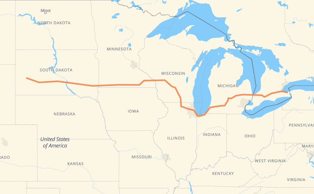
The distance from Box Elder to St. Catharines is 2,278 kilometers by road including 2,274 kilometers on motorways. Road takes approximately 21 hours and 16 minutes and goes through Mitchell, Sioux Falls, Brandon, Madison, Janesville, Chicago and Kalamazoo.
| Shortest distance by air | 1,914 km ✈️ |
| Car route length | 2,278 km 🚗 |
| Driving time | 21 h 16 min |
| Fuel amount | 182.3 L |
| Fuel cost | 357.2 CAD |
| Point | Distance | Time | Fuel | |
| Box Elder | 0 km | 00 min | 0.0 L | |
|
I 90 418 km, 3 h 48 min
|
||||
| Mitchell | 418 km | 3 h 48 min | 32.3 L | |
|
I 90 116 km, 1 h 03 min
|
||||
| Sioux Falls | 534 km | 4 h 52 min | 42.4 L | |
|
I 90 11 km, 06 min
|
||||
| Brandon | 545 km | 4 h 58 min | 43.3 L | |
|
I 90 676 km, 6 h 11 min
|
||||
| Madison | 1,221 km | 11 h 10 min | 97.0 L | |
|
I 39 56 km, 30 min
|
||||
| Janesville | 1,277 km | 11 h 40 min | 101.8 L | |
|
I 39 I 90 173 km, 1 h 39 min
|
||||
| Chicago | 1,451 km | 13 h 20 min | 114.2 L | |
|
I 90 I 94 231 km, 2 h 12 min
|
||||
| Kalamazoo | 1,682 km | 15 h 32 min | 134.4 L | |
|
I 94 I 69 104 km, 56 min
|
||||
| Lansing | 1,786 km | 16 h 29 min | 142.7 L | |
|
I 69 99 km, 54 min
|
||||
| Flint | 1,885 km | 17 h 23 min | 150.4 L | |
|
I 69 122 km, 1 h 14 min
|
||||
| Sarnia | 2,007 km | 18 h 38 min | 159.9 L | |
|
402 141 km, 1 h 20 min
|
||||
| Woodstock | 2,148 km | 19 h 58 min | 171.4 L | |
|
401 403 39 km, 23 min
|
||||
| Brantford | 2,187 km | 20 h 21 min | 174.5 L | |
|
403 QEW 91 km, 54 min
|
||||
| St. Catharines | 2,278 km | 21 h 16 min | 181.7 L | |
Hotels of St. Catharines
Frequently Asked Questions
How much does it cost to drive from Box Elder to St. Catharines?
Fuel cost: 357.2 CAD
This fuel cost is calculated as: (Route length 2,278 km / 100 km) * (Fuel consumption 8 L/100 km) * (Fuel price 1.96 CAD / L)
You can adjust fuel consumption and fuel price here.
How long is a car ride from Box Elder to St. Catharines?
Driving time: 21 h 16 min
This time is calculated for driving at the maximum permitted speed, taking into account traffic rules restrictions.
- 1,901 km with a maximum speed 110 km/h = 17 h 16 min
- 24 km with a maximum speed 105 km/h = 13 min
- 236 km with a maximum speed 100 km/h = 2 h 21 min
- 35 km with a maximum speed 97 km/h = 21 min
- 19 km with a maximum speed 90 km/h = 12 min
- 22 km with a maximum speed 89 km/h = 15 min
- 23 km with a maximum speed 80 km/h = 16 min
- 13 km with a maximum speed 72 km/h = 10 min
- 1 km with a maximum speed 70 km/h = 1 min
- 1 km with a maximum speed 56 km/h = 1 min
- 2 km with a maximum speed 50 km/h = 2 min
- 2 km with a maximum speed 40 km/h = 2 min
The calculated driving time does not take into account intermediate stops and traffic jams.
How far is Box Elder to St. Catharines by land?
The distance between Box Elder and St. Catharines is 2,278 km by road including 2,274 km on motorways.
Precise satellite coordinates of highways were used for this calculation. The start and finish points are the centers of Box Elder and St. Catharines respectively.
How far is Box Elder to St. Catharines by plane?
The shortest distance (air line, as the crow flies) between Box Elder and St. Catharines is 1,914 km.
This distance is calculated using the Haversine formula as a great-circle distance between two points on the surface of a sphere. The start and finish points are the centers of Box Elder and St. Catharines respectively. Actual distance between airports may be different.
How many hours is Box Elder from St. Catharines by plane?
Boeing 737 airliner needs 2 h 23 min to cover the distance of 1,914 km at a cruising speed of 800 km/h.
Small plane "Cessna 172" needs 8 h 42 min to flight this distance at average speed of 220 km/h.
This time is approximate and do not take into account takeoff and landing times, airport location and other real world factors.
How long is a helicopter ride from Box Elder to St. Catharines?
Fast helicopter "Eurocopter AS350" or "Hughes OH-6 Cayuse" need 7 h 58 min to cover the distance of 1,914 km at a cruising speed of 240 km/h.
Popular "Robinson R44" needs 9 h 6 min to flight this distance at average speed of 210 km/h.
This time is approximate and do not take into account takeoff and landing times, aerodrome location and other real world factors.
What city is halfway between Box Elder and St. Catharines?
The halfway point between Box Elder and St. Catharines is Wisconsin Dells. It is located about 13 km from the exact midpoint by road.
The distance from Wisconsin Dells to Box Elder is 1,126 km and driving will take about 10 h 17 min. The road between Wisconsin Dells and St. Catharines has length 1,152 km and will take approximately 10 h 59 min.
The other cities located close to halfway point:
Where is Box Elder in relation to St. Catharines?
Box Elder is located 1,914 km west of St. Catharines.
Box Elder has geographic coordinates: latitude 44.13337, longitude -103.06451.
St. Catharines has geographic coordinates: latitude 43.16738, longitude -79.24164.
Which highway goes from Box Elder to St. Catharines?
The route from Box Elder to St. Catharines follows I 90, I 94, I 69, I 39, 402.
Other minor sections pass along the road:
- US 14: 78 km
- 403: 64 km
- 401: 50 km
- QEW: 41 km
- US 51: 32 km
- US 83: 31 km
- SD 63: 11 km
- SD 73: 10 km
- SD 50: 10 km
- 24: 8 km
- SD 45: 7 km
- US 61: 7 km
- I 96: 7 km
- US 31: 5 km
- MN 43: 4 km
- US 218: 4 km
- WI 11: 3 km
- SD 37: 2 km
- US 53: 2 km