Distance between Baie-Comeau QC and Cow Head NL
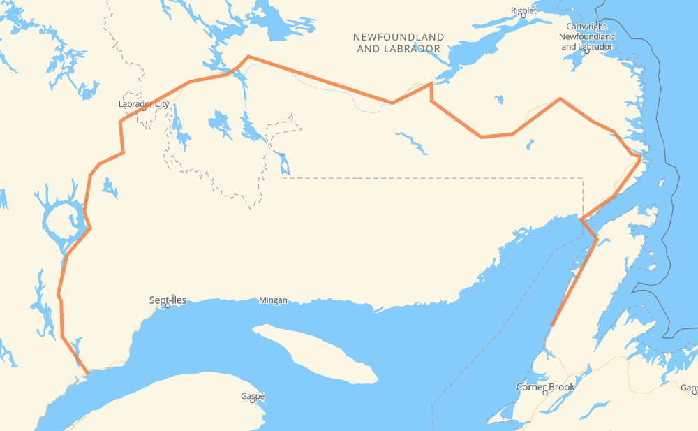
The distance from Baie-Comeau to Cow Head is 1,938 kilometers by road. Road takes approximately 23 hours and 39 minutes and goes through Labrador City, Wabush, Churchill Falls, Port Hope Simpson, Lodge Bay, Mary’s Harbour and L'Anse-au-Clair.
| Shortest distance by air | 750 km ✈️ |
| Car route length | 1,938 km 🚗 |
| Driving time | 23 h 39 min |
| Fuel amount | 155.1 L |
| Fuel cost | 303.9 CAD |
| Point | Distance | Time | Fuel | |
| Baie-Comeau | 0 km | 00 min | 0.0 L | |
|
389 579 km, 6 h 29 min
|
||||
| Labrador City | 579 km | 6 h 29 min | 45.6 L | |
|
500 38 km, 28 min
|
||||
| Wabush | 618 km | 6 h 58 min | 47.2 L | |
|
500 228 km, 2 h 42 min
|
||||
| Churchill Falls | 846 km | 9 h 40 min | 64.6 L | |
|
500 510 656 km, 7 h 21 min
|
||||
| Port Hope Simpson | 1,501 km | 17 h 02 min | 118.6 L | |
|
510 96 km, 1 h 10 min
|
||||
| Lodge Bay | 1,598 km | 18 h 12 min | 123.5 L | |
|
510 75 km, 56 min
|
||||
| L'Anse au Loup | 1,673 km | 19 h 09 min | 132.2 L | |
|
510 24 km, 18 min
|
||||
| Forteau | 1,697 km | 19 h 27 min | 135.5 L | |
|
510 9 km, 06 min
|
||||
| L'Anse-au-Clair | 1,706 km | 19 h 33 min | 136.5 L | |
|
510 430 232 km, 4 h 05 min
|
||||
| Cow Head | 1,938 km | 23 h 39 min | 153.6 L | |
Hotels of Cow Head
Frequently Asked Questions
How much does it cost to drive from Baie-Comeau to Cow Head?
Fuel cost: 303.9 CAD
This fuel cost is calculated as: (Route length 1,938 km / 100 km) * (Fuel consumption 8 L/100 km) * (Fuel price 1.96 CAD / L)
You can adjust fuel consumption and fuel price here.
How long is a car ride from Baie-Comeau to Cow Head?
Driving time: 23 h 39 min
This time is calculated for driving at the maximum permitted speed, taking into account traffic rules restrictions.
- 1,379 km with a maximum speed 90 km/h = 15 h 19 min
- 522 km with a maximum speed 80 km/h = 6 h 31 min
- 1 km with a maximum speed 50 km/h = 1 min
- 36 km with a maximum speed 20 km/h = 1 h 47 min
The calculated driving time does not take into account intermediate stops and traffic jams.
How far is Baie-Comeau to Cow Head by land?
The distance between Baie-Comeau and Cow Head is 1,938 km by road.
Precise satellite coordinates of highways were used for this calculation. The start and finish points are the centers of Baie-Comeau and Cow Head respectively.
How far is Baie-Comeau to Cow Head by plane?
The shortest distance (air line, as the crow flies) between Baie-Comeau and Cow Head is 750 km.
This distance is calculated using the Haversine formula as a great-circle distance between two points on the surface of a sphere. The start and finish points are the centers of Baie-Comeau and Cow Head respectively. Actual distance between airports may be different.
How many hours is Baie-Comeau from Cow Head by plane?
Boeing 737 airliner needs 56 min to cover the distance of 750 km at a cruising speed of 800 km/h.
Small plane "Cessna 172" needs 3 h 24 min to flight this distance at average speed of 220 km/h.
This time is approximate and do not take into account takeoff and landing times, airport location and other real world factors.
How long is a helicopter ride from Baie-Comeau to Cow Head?
Fast helicopter "Eurocopter AS350" or "Hughes OH-6 Cayuse" need 3 h 7 min to cover the distance of 750 km at a cruising speed of 240 km/h.
Popular "Robinson R44" needs 3 h 34 min to flight this distance at average speed of 210 km/h.
This time is approximate and do not take into account takeoff and landing times, aerodrome location and other real world factors.
What city is halfway between Baie-Comeau and Cow Head?
The halfway point between Baie-Comeau and Cow Head is Churchill Falls. It is located about 124 km from the exact midpoint by road.
The distance from Churchill Falls to Baie-Comeau is 846 km and driving will take about 9 h 40 min. The road between Churchill Falls and Cow Head has length 1,093 km and will take approximately 13 h 58 min.
Where is Baie-Comeau in relation to Cow Head?
Baie-Comeau is located 750 km west of Cow Head.
Baie-Comeau has geographic coordinates: latitude 49.2176, longitude -68.15231.
Cow Head has geographic coordinates: latitude 49.9208, longitude -57.80571.
Which highway goes from Baie-Comeau to Cow Head?
The route from Baie-Comeau to Cow Head follows 510, 389, 500, 430.
Other minor sections pass along the road:
- 138: 5 km
- 430-21: 3 km
- 430-50: 2 km
- 430-20: 1 km