Distance between Amareleja and Calvão
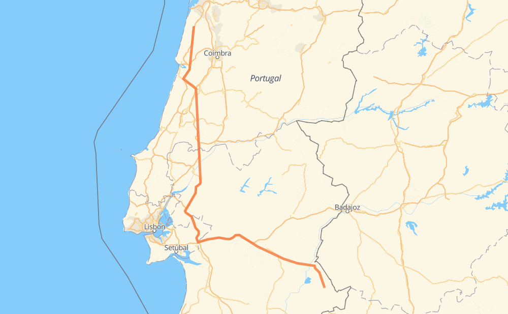
The distance from Amareleja to Calvão is 410 kilometers by road including 288 kilometers on motorways. Road takes approximately 4 hours and 15 minutes and goes through Mourão, Reguengos de Monsaraz, Nossa Senhora da Vila, Nossa Senhora do Bispo, Afeiteira, Marvila and São Nicolau.
| Shortest distance by air | 282 km ✈️ |
| Car route length | 410 km 🚗 |
| Driving time | 4 h 15 min |
| Fuel amount | 32.8 L |
| Fuel cost | 64.4 CAD |
| Point | Distance | Time | Fuel | |
| Amareleja | 0 km | 00 min | 0.0 L | |
|
EN 386 ER 385 20 km, 15 min
|
||||
| Mourão | 20 km | 15 min | 1.3 L | |
|
ER 385 EN 256 18 km, 13 min
|
||||
| Reguengos de Monsaraz | 37 km | 28 min | 2.3 L | |
|
EN 256 64 km, 45 min
|
||||
| Nossa Senhora da Vila | 101 km | 1 h 14 min | 7.5 L | |
|
A 6 17 km, 11 min
|
||||
| Nossa Senhora do Bispo | 119 km | 1 h 25 min | 8.7 L | |
|
A 6 20 km, 10 min
|
||||
| Afeiteira | 138 km | 1 h 36 min | 10.8 L | |
|
A 6 A 13 94 km, 51 min
|
||||
| Marvila | 232 km | 2 h 28 min | 18.4 L | |
|
IC 10 5 km, 03 min
|
||||
| São Nicolau | 237 km | 2 h 31 min | 18.8 L | |
|
IC 10 8 km, 04 min
|
||||
| Salvador | 245 km | 2 h 36 min | 19.2 L | |
|
A 1 165 km, 1 h 38 min
|
||||
| Santo André de Vagos | 410 km | 4 h 15 min | 32.7 L | |
Hotels of Calvão
Frequently Asked Questions
How much does it cost to drive from Amareleja to Calvão?
Fuel cost: 64.4 CAD
This fuel cost is calculated as: (Route length 410 km / 100 km) * (Fuel consumption 8 L/100 km) * (Fuel price 1.96 CAD / L)
You can adjust fuel consumption and fuel price here.
How long is a car ride from Amareleja to Calvão?
Driving time: 4 h 15 min
This time is calculated for driving at the maximum permitted speed, taking into account traffic rules restrictions.
- 222 km with a maximum speed 110 km/h = 2 h 1 min
- 32 km with a maximum speed 100 km/h = 19 min
- 65 km with a maximum speed 90 km/h = 43 min
- 77 km with a maximum speed 80 km/h = 58 min
- 9 km with a maximum speed 70 km/h = 7 min
- 2 km with a maximum speed 60 km/h = 1 min
- 3 km with a maximum speed 50 km/h = 3 min
- 1 km with a maximum speed 40 km/h = 1 min
The calculated driving time does not take into account intermediate stops and traffic jams.
How far is Amareleja to Calvão by land?
The distance between Amareleja and Calvão is 410 km by road including 288 km on motorways.
Precise satellite coordinates of highways were used for this calculation. The start and finish points are the centers of Amareleja and Calvão respectively.
How far is Amareleja to Calvão by plane?
The shortest distance (air line, as the crow flies) between Amareleja and Calvão is 282 km.
This distance is calculated using the Haversine formula as a great-circle distance between two points on the surface of a sphere. The start and finish points are the centers of Amareleja and Calvão respectively. Actual distance between airports may be different.
How many hours is Amareleja from Calvão by plane?
Boeing 737 airliner needs 21 min to cover the distance of 282 km at a cruising speed of 800 km/h.
Small plane "Cessna 172" needs 1 h 16 min to flight this distance at average speed of 220 km/h.
This time is approximate and do not take into account takeoff and landing times, airport location and other real world factors.
How long is a helicopter ride from Amareleja to Calvão?
Fast helicopter "Eurocopter AS350" or "Hughes OH-6 Cayuse" need 1 h 10 min to cover the distance of 282 km at a cruising speed of 240 km/h.
Popular "Robinson R44" needs 1 h 20 min to flight this distance at average speed of 210 km/h.
This time is approximate and do not take into account takeoff and landing times, aerodrome location and other real world factors.
What city is halfway between Amareleja and Calvão?
The halfway point between Amareleja and Calvão is Granho. It is located about 9 km from the exact midpoint by road.
The distance from Granho to Amareleja is 215 km and driving will take about 2 h 17 min. The road between Granho and Calvão has length 196 km and will take approximately 1 h 57 min.
The other cities located close to halfway point:
Where is Amareleja in relation to Calvão?
Amareleja is located 282 km south-east of Calvão.
Amareleja has geographic coordinates: latitude 38.20711, longitude -7.22636.
Calvão has geographic coordinates: latitude 40.47674, longitude -8.69516.