Distance between Alta Floresta and Rio Pardo de Minas
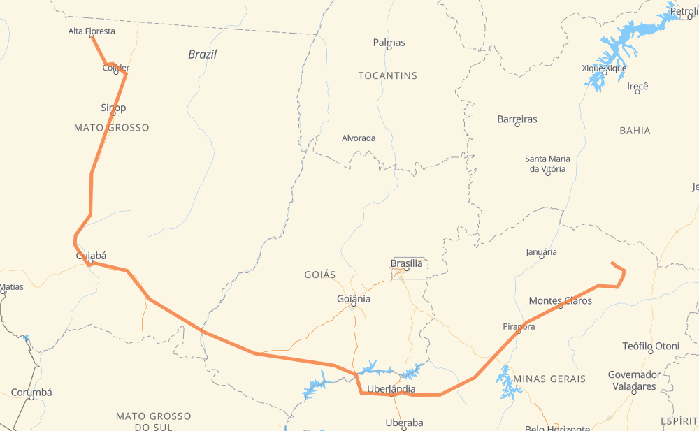
The distance from Alta Floresta to Rio Pardo de Minas is 2,801 kilometers by road including 235 kilometers on motorways. Road takes approximately 31 hours and 51 minutes and goes through Sorriso, Mário Raiter, Novo Mundo, Jaciara, Vila Goulart, Centralina and Monte Alegre de Minas.
| Shortest distance by air | 1,601 km ✈️ |
| Car route length | 2,801 km 🚗 |
| Driving time | 31 h 51 min |
| Fuel amount | 224.1 L |
| Fuel cost | 439.2 CAD |
| Point | Distance | Time | Fuel | |
| -9.87150, -56.08399 | 0 km | 00 min | 0.0 L | |
|
BR-163 397 km, 4 h 36 min
|
||||
| Sorriso | 397 km | 4 h 36 min | 62.9 L | |
|
BR-163 399 km, 4 h 36 min
|
||||
| Novo Mundo | 796 km | 9 h 13 min | 94.7 L | |
|
BR-163 159 km, 1 h 46 min
|
||||
| Jaciara | 955 km | 11 h 00 min | 107.4 L | |
|
BR-163 76 km, 53 min
|
||||
| Vila Goulart | 1,031 km | 11 h 53 min | 113.8 L | |
|
BR-364 707 km, 7 h 58 min
|
||||
| Centralina | 1,738 km | 19 h 51 min | 169.7 L | |
|
BR-153 61 km, 33 min
|
||||
| Monte Alegre de Minas | 1,799 km | 20 h 25 min | 173.3 L | |
|
BR-365 53 km, 29 min
|
||||
| Tocantins | 1,852 km | 20 h 54 min | 179.5 L | |
|
BR-365 3 km, 02 min
|
||||
| Dona Zulmira | 1,855 km | 20 h 57 min | 179.7 L | |
|
BR-365 221 km, 2 h 29 min
|
||||
| Distrito Industrial I | 2,076 km | 23 h 26 min | 197.4 L | |
|
BR-365 726 km, 8 h 24 min
|
||||
| Rio Pardo de Minas | 2,801 km | 31 h 50 min | 252.0 L | |
Frequently Asked Questions
How much does it cost to drive from Alta Floresta to Rio Pardo de Minas?
Fuel cost: 439.2 CAD
This fuel cost is calculated as: (Route length 2,801 km / 100 km) * (Fuel consumption 8 L/100 km) * (Fuel price 1.96 CAD / L)
You can adjust fuel consumption and fuel price here.
How long is a car ride from Alta Floresta to Rio Pardo de Minas?
Driving time: 31 h 51 min
This time is calculated for driving at the maximum permitted speed, taking into account traffic rules restrictions.
- 180 km with a maximum speed 110 km/h = 1 h 38 min
- 46 km with a maximum speed 100 km/h = 27 min
- 1,850 km with a maximum speed 90 km/h = 20 h 33 min
- 705 km with a maximum speed 80 km/h = 8 h 48 min
- 12 km with a maximum speed 60 km/h = 11 min
- 3 km with a maximum speed 50 km/h = 3 min
- 5 km with a maximum speed 40 km/h = 7 min
The calculated driving time does not take into account intermediate stops and traffic jams.
How far is Alta Floresta to Rio Pardo de Minas by land?
The distance between Alta Floresta and Rio Pardo de Minas is 2,801 km by road including 235 km on motorways.
Precise satellite coordinates of highways were used for this calculation. The start and finish points are the centers of Alta Floresta and Rio Pardo de Minas respectively.
How far is Alta Floresta to Rio Pardo de Minas by plane?
The shortest distance (air line, as the crow flies) between Alta Floresta and Rio Pardo de Minas is 1,601 km.
This distance is calculated using the Haversine formula as a great-circle distance between two points on the surface of a sphere. The start and finish points are the centers of Alta Floresta and Rio Pardo de Minas respectively. Actual distance between airports may be different.
How many hours is Alta Floresta from Rio Pardo de Minas by plane?
Boeing 737 airliner needs 2 h to cover the distance of 1,601 km at a cruising speed of 800 km/h.
Small plane "Cessna 172" needs 7 h 16 min to flight this distance at average speed of 220 km/h.
This time is approximate and do not take into account takeoff and landing times, airport location and other real world factors.
How long is a helicopter ride from Alta Floresta to Rio Pardo de Minas?
Fast helicopter "Eurocopter AS350" or "Hughes OH-6 Cayuse" need 6 h 40 min to cover the distance of 1,601 km at a cruising speed of 240 km/h.
Popular "Robinson R44" needs 7 h 37 min to flight this distance at average speed of 210 km/h.
This time is approximate and do not take into account takeoff and landing times, aerodrome location and other real world factors.
What city is halfway between Alta Floresta and Rio Pardo de Minas?
The halfway point between Alta Floresta and Rio Pardo de Minas is Lagoa do Bauzinho. It is located about 168 km from the exact midpoint by road.
The distance from Lagoa do Bauzinho to Alta Floresta is 1,568 km and driving will take about 17 h 51 min. The road between Lagoa do Bauzinho and Rio Pardo de Minas has length 1,233 km and will take approximately 14 h.
The other cities located close to halfway point:
Where is Alta Floresta in relation to Rio Pardo de Minas?
Alta Floresta is located 1,601 km north-west of Rio Pardo de Minas.
Alta Floresta has geographic coordinates: latitude -9.8715, longitude -56.08399.
Rio Pardo de Minas has geographic coordinates: latitude -15.62033, longitude -42.54539.
Which highway goes from Alta Floresta to Rio Pardo de Minas?
The route from Alta Floresta to Rio Pardo de Minas follows BR-163, BR-364, BR-365, BR-251, BR-452, MT-320.
Other minor sections pass along the road:
- BR-060: 96 km
- BR-070: 82 km
- BR-153: 57 km
- LMG-629: 42 km
- MG-404: 42 km
- MT-208: 27 km
- BR-122: 19 km
- LMG-653: 16 km
- MT-407: 16 km
- MGC-251: 9 km
- MGC-122: 9 km
- CMG-122: 9 km
- CMG-251: 9 km
- LMG-626: 7 km
- MT-100: 7 km
- BR-158: 5 km
- BR-050: 5 km
- CMG-135: 2 km
- BR-135: 2 km