Distance between Aguascalientes and Acapulco
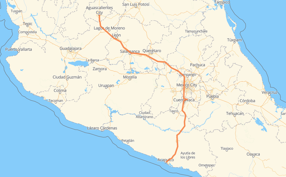
The distance from Aguascalientes to Acapulco is 866 kilometers by road including 809 kilometers on motorways. Road takes approximately 9 hours and 6 minutes and goes through Salamanca, Celaya, Cuernavaca and Chilpancingo.
| Shortest distance by air | 613 km ✈️ |
| Car route length | 866 km 🚗 |
| Driving time | 9 h 6 min |
| Fuel amount | 69.3 L |
| Fuel cost | 135.8 CAD |
| Toll roads cost | 1,142 + ? MXN |
| Point | Distance | Time | Fuel | |
| Aguascalientes | 0 km | 00 min | 0.0 L | |
|
MEX 45 MEX 70 43 km, 27 min
|
||||
| Encarnación de Díaz | 43 km | 27 min | 3.2 L | |
|
MEX 45D 143 km, 1 h 19 min
|
||||
| Mendoza | 185 km | 1 h 46 min | 14.1 L | |
|
MEX 43D 20 km, 12 min
|
||||
| Salamanca | 206 km | 1 h 59 min | 16.5 L | |
|
MEX 45D 31 km, 18 min
|
||||
| Celaya | 237 km | 2 h 17 min | 18.6 L | |
|
MEX 45D 15 km, 08 min
|
||||
| Apaseo el Grande | 252 km | 2 h 25 min | 19.9 L | |
|
MEX 45D MEX 57D 190 km, 1 h 51 min
|
||||
| Coyotepec | 442 km | 4 h 17 min | 35.2 L | |
|
MEX 57D MEX 95D 136 km, 1 h 38 min
|
||||
| Cuernavaca | 577 km | 5 h 56 min | 45.5 L | |
|
MEX 95D 180 km, 1 h 56 min
|
||||
| Chilpancingo | 757 km | 7 h 52 min | 60.0 L | |
|
MEX 95D 109 km, 1 h 13 min
|
||||
| Acapulco | 866 km | 9 h 06 min | 68.8 L | |
Hotels of Acapulco
Frequently Asked Questions
How many toll booths are there from Aguascalientes to Acapulco?
There are 15 toll booths between Aguascalientes and Acapulco: Encarnacion De Diaz, León - Aguascalientes, Puerto Interior, Mendoza, Cerro Gordo, Maxitúnel Acapulco, La Venta, Palo Blanco, Paso Morelos, Francisco Velasco, Tlalpan, Palmillas, Palmilas - Apaseo, Tepotzotlán and Urbana Norte - Viaducto Minería.
How much does the toll booths cost from Aguascalientes to Acapulco?
Toll roads cost: Encarnacion De Diaz (150 MXN) + León - Aguascalientes (153 MXN) + Puerto Interior (?) + Mendoza (53 MXN) + Cerro Gordo (?) + Palmilas - Apaseo (?) + Palmillas (89 MXN) + Tepotzotlán (89 MXN) + Urbana Norte - Viaducto Minería (?) + Tlalpan (114 MXN) + Francisco Velasco (73 MXN) + Paso Morelos (154 MXN) + Palo Blanco (142 MXN) + La Venta (125 MXN) + Maxitúnel Acapulco (?) = 1,142 + ? MXN
How much does it cost to drive from Aguascalientes to Acapulco?
Fuel cost: 135.8 CAD
This fuel cost is calculated as: (Route length 866 km / 100 km) * (Fuel consumption 8 L/100 km) * (Fuel price 1.96 CAD / L)
You can adjust fuel consumption and fuel price here.
Toll roads cost: 1,142 + ? MXN
How long is a car ride from Aguascalientes to Acapulco?
Driving time: 9 h 6 min
This time is calculated for driving at the maximum permitted speed, taking into account traffic rules restrictions.
- 302 km with a maximum speed 110 km/h = 2 h 44 min
- 272 km with a maximum speed 100 km/h = 2 h 43 min
- 48 km with a maximum speed 90 km/h = 32 min
- 236 km with a maximum speed 80 km/h = 2 h 57 min
- 1 km with a maximum speed 70 km/h = 1 min
- 4 km with a maximum speed 50 km/h = 5 min
- 2 km with a maximum speed 40 km/h = 2 min
The calculated driving time does not take into account intermediate stops and traffic jams.
How far is Aguascalientes to Acapulco by land?
The distance between Aguascalientes and Acapulco is 866 km by road including 809 km on motorways.
Precise satellite coordinates of highways were used for this calculation. The start and finish points are the centers of Aguascalientes and Acapulco respectively.
How far is Aguascalientes to Acapulco by plane?
The shortest distance (air line, as the crow flies) between Aguascalientes and Acapulco is 613 km.
This distance is calculated using the Haversine formula as a great-circle distance between two points on the surface of a sphere. The start and finish points are the centers of Aguascalientes and Acapulco respectively. Actual distance between airports may be different.
How many hours is Aguascalientes from Acapulco by plane?
Boeing 737 airliner needs 45 min to cover the distance of 613 km at a cruising speed of 800 km/h.
Small plane "Cessna 172" needs 2 h 47 min to flight this distance at average speed of 220 km/h.
This time is approximate and do not take into account takeoff and landing times, airport location and other real world factors.
How long is a helicopter ride from Aguascalientes to Acapulco?
Fast helicopter "Eurocopter AS350" or "Hughes OH-6 Cayuse" need 2 h 33 min to cover the distance of 613 km at a cruising speed of 240 km/h.
Popular "Robinson R44" needs 2 h 55 min to flight this distance at average speed of 210 km/h.
This time is approximate and do not take into account takeoff and landing times, aerodrome location and other real world factors.
What city is halfway between Aguascalientes and Acapulco?
The halfway point between Aguascalientes and Acapulco is Coyotepec. It is located about 9 km from the exact midpoint by road.
The distance from Coyotepec to Aguascalientes is 442 km and driving will take about 4 h 17 min. The road between Coyotepec and Acapulco has length 424 km and will take approximately 4 h 48 min.
The other cities located close to halfway point:
Where is Aguascalientes in relation to Acapulco?
Aguascalientes is located 613 km north-west of Acapulco.
Aguascalientes has geographic coordinates: latitude 21.88066, longitude -102.29613.
Acapulco has geographic coordinates: latitude 16.86029, longitude -99.87683.
Which highway goes from Aguascalientes to Acapulco?
The route from Aguascalientes to Acapulco follows MEX 95D, MEX 45D, MEX 57D.
Other minor sections pass along the road:
- MEX 47D: 83 km
- MEX 43D: 77 km
- MEX 70: 47 km
- MEX 45: 28 km
- Periférico: 14 km
- MEX 57: 10 km
- Periferico Norte: 7 km