Distance between Agoo and Tayasan
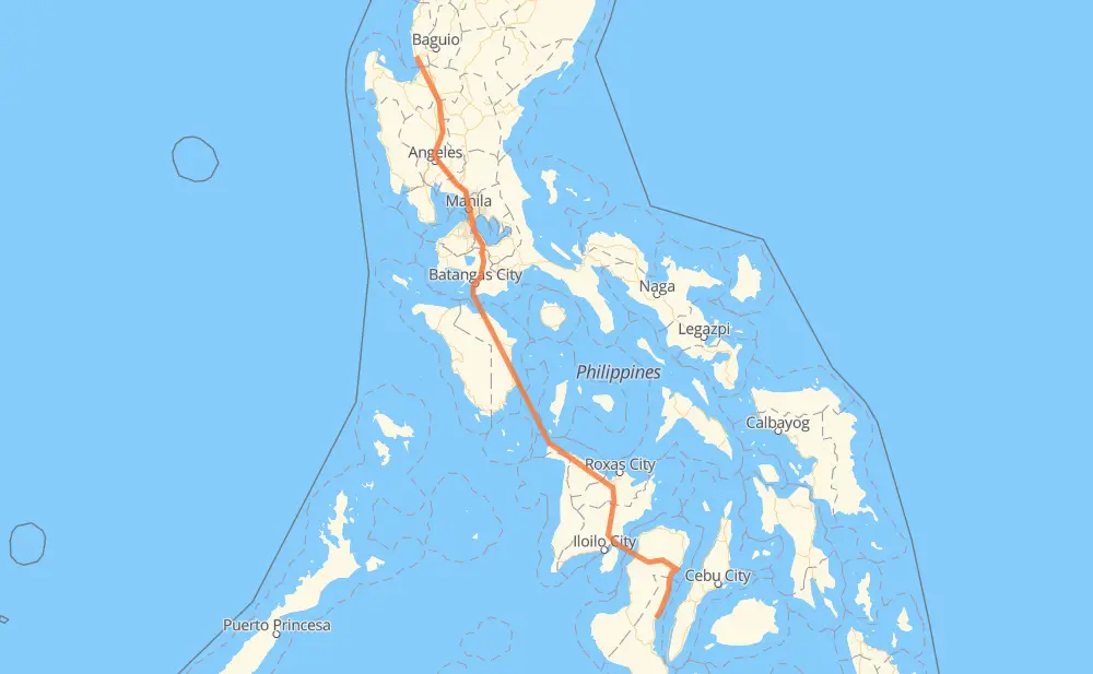
The distance from Agoo to Tayasan is 1,002 kilometers by road including 297 kilometers on motorways. Road takes approximately 17 hours and 58 minutes and goes through San Pedro, Biñan, Santa Rosa, Cabuyao, Calamba, Tanauan and Lipa.
| Shortest distance by air | 774 km ✈️ |
| Car route length | 1,002 km 🚗 |
| Driving time | 17 h 58 min |
| Fuel amount | 80.1 L |
| Fuel cost | 157.1 CAD |
| Point | Distance | Time | Fuel | |
| Agoo | 0 km | 00 min | 0.0 L | |
|
2 E1 261 km, 2 h 50 min
|
||||
| San Pedro | 261 km | 2 h 50 min | 20.7 L | |
|
E2 5 km, 03 min
|
||||
| Biñan | 266 km | 2 h 53 min | 21.0 L | |
|
E2 6 km, 03 min
|
||||
| Santa Rosa | 272 km | 2 h 57 min | 21.5 L | |
|
E2 3 km, 01 min
|
||||
| Cabuyao | 275 km | 2 h 59 min | 22.0 L | |
|
E2 6 km, 03 min
|
||||
| Calamba | 282 km | 3 h 03 min | 22.1 L | |
|
E2 11 km, 06 min
|
||||
| Tanauan | 292 km | 3 h 09 min | 23.2 L | |
|
E2 16 km, 09 min
|
||||
| Lipa | 308 km | 3 h 19 min | 24.4 L | |
|
E2 25 km, 17 min
|
||||
| Batangas City | 333 km | 3 h 36 min | 26.3 L | |
|
434 452 51 km, 2 h 17 min
|
||||
| Calapan | 385 km | 5 h 54 min | 30.7 L | |
|
452 381 km, 8 h 08 min
|
||||
| City of Passi | 765 km | 14 h 02 min | 61.1 L | |
|
5 76 km, 1 h 59 min
|
||||
| Bacólod | 842 km | 16 h 02 min | 67.3 L | |
|
7 69 83 km, 1 h 00 min
|
||||
| San Carlos | 925 km | 17 h 03 min | 73.8 L | |
|
69 7 51 km, 36 min
|
||||
| Guihulngan | 976 km | 17 h 39 min | 77.6 L | |
|
7 25 km, 18 min
|
||||
| Tayasan | 1,002 km | 17 h 58 min | 79.9 L | |
Frequently Asked Questions
How much does it cost to drive from Agoo to Tayasan?
Fuel cost: 157.1 CAD
This fuel cost is calculated as: (Route length 1,002 km / 100 km) * (Fuel consumption 8 L/100 km) * (Fuel price 1.96 CAD / L)
You can adjust fuel consumption and fuel price here.
How long is a car ride from Agoo to Tayasan?
Driving time: 17 h 58 min
This time is calculated for driving at the maximum permitted speed, taking into account traffic rules restrictions.
- 288 km with a maximum speed 100 km/h = 2 h 53 min
- 77 km with a maximum speed 90 km/h = 51 min
- 431 km with a maximum speed 80 km/h = 5 h 23 min
- 4 km with a maximum speed 70 km/h = 3 min
- 23 km with a maximum speed 60 km/h = 22 min
- 9 km with a maximum speed 50 km/h = 11 min
- 7 km with a maximum speed 40 km/h = 10 min
- 2 km with a maximum speed 30 km/h = 3 min
- 160 km with a maximum speed 20 km/h = 7 h 58 min
The calculated driving time does not take into account intermediate stops and traffic jams.
How far is Agoo to Tayasan by land?
The distance between Agoo and Tayasan is 1,002 km by road including 297 km on motorways.
Precise satellite coordinates of highways were used for this calculation. The start and finish points are the centers of Agoo and Tayasan respectively.
How far is Agoo to Tayasan by plane?
The shortest distance (air line, as the crow flies) between Agoo and Tayasan is 774 km.
This distance is calculated using the Haversine formula as a great-circle distance between two points on the surface of a sphere. The start and finish points are the centers of Agoo and Tayasan respectively. Actual distance between airports may be different.
How many hours is Agoo from Tayasan by plane?
Boeing 737 airliner needs 58 min to cover the distance of 774 km at a cruising speed of 800 km/h.
Small plane "Cessna 172" needs 3 h 31 min to flight this distance at average speed of 220 km/h.
This time is approximate and do not take into account takeoff and landing times, airport location and other real world factors.
How long is a helicopter ride from Agoo to Tayasan?
Fast helicopter "Eurocopter AS350" or "Hughes OH-6 Cayuse" need 3 h 13 min to cover the distance of 774 km at a cruising speed of 240 km/h.
Popular "Robinson R44" needs 3 h 41 min to flight this distance at average speed of 210 km/h.
This time is approximate and do not take into account takeoff and landing times, aerodrome location and other real world factors.
What city is halfway between Agoo and Tayasan?
The halfway point between Agoo and Tayasan is Cawayan. It is located about 1 km from the exact midpoint by road.
The distance from Cawayan to Agoo is 501 km and driving will take about 7 h 20 min. The road between Cawayan and Tayasan has length 500 km and will take approximately 10 h 38 min.
The other cities located close to halfway point:
Where is Agoo in relation to Tayasan?
Agoo is located 774 km north-west of Tayasan.
Agoo has geographic coordinates: latitude 16.32233, longitude 120.36608.
Tayasan has geographic coordinates: latitude 9.92313, longitude 123.17236.
Which highway goes from Agoo to Tayasan?
The route from Agoo to Tayasan follows E1, 452.
Other minor sections pass along the road:
- E2: 93 km
- 503: 86 km
- 69: 81 km
- 7: 78 km
- 5: 66 km
- AH26: 40 km
- 502: 23 km
- 2: 21 km
- 454: 21 km
- SRNH: 6 km
- 514: 6 km
- 140: 5 km
- 160: 4 km
- 434: 4 km
- 145: 3 km
- 161: 1 km