Distance between Águas Vermelhas and Humaitá
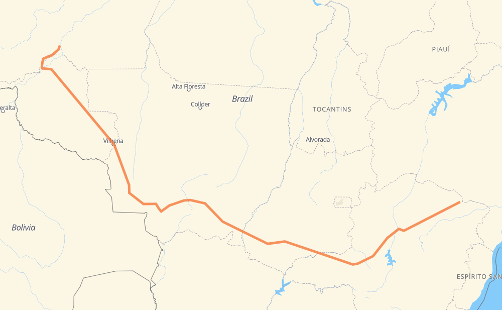
The distance from Águas Vermelhas to Humaitá is 3,670 kilometers by road including 132 kilometers on motorways. Road takes approximately 43 hours and 36 minutes and goes through Ariquemes, Porto Velho, Salinas, Francisco Sá, Santo Amaro, São Geraldo and Cidade Jardim Mansões.
| Shortest distance by air | 2,519 km ✈️ |
| Car route length | 3,670 km 🚗 |
| Driving time | 43 h 36 min |
| Fuel amount | 293.6 L |
| Fuel cost | 581.3 CAD |
| Point | Distance | Time | Fuel | |
| Águas Vermelhas | 0 km | 00 min | 0.0 L | |
|
LMG-618 BR-251 140 km, 1 h 44 min
|
||||
| Salinas | 140 km | 1 h 44 min | 9.8 L | |
|
BR-251 137 km, 1 h 40 min
|
||||
| Francisco Sá | 277 km | 3 h 24 min | 20.0 L | |
|
BR-251 67 km, 47 min
|
||||
| Santo Amaro | 344 km | 4 h 12 min | 27.5 L | |
|
LMG-653 BR-365 161 km, 1 h 49 min
|
||||
| São Geraldo | 505 km | 6 h 02 min | 40.2 L | |
|
BR-365 6 km, 04 min
|
||||
| Cidade Jardim Mansões | 511 km | 6 h 07 min | 40.8 L | |
|
BR-365 244 km, 2 h 43 min
|
||||
| Distrito Industrial I | 755 km | 8 h 50 min | 60.4 L | |
|
BR-365 231 km, 2 h 33 min
|
||||
| Tocantins | 987 km | 11 h 23 min | 78.1 L | |
|
BR-365 BR-364 2,264 km, 27 h 01 min
|
||||
| Ariquemes | 3,251 km | 38 h 25 min | 258.1 L | |
|
BR-364 217 km, 2 h 37 min
|
||||
| Porto Velho | 3,468 km | 41 h 02 min | 277.3 L | |
|
BR-319 206 km, 2 h 33 min
|
||||
| -7.50994, -63.02487 | 3,674 km | 43 h 36 min | 293.9 L | |
Frequently Asked Questions
How much does it cost to drive from Águas Vermelhas to Humaitá?
Fuel cost: 581.3 CAD
This fuel cost is calculated as: (Route length 3,670 km / 100 km) * (Fuel consumption 8 L/100 km) * (Fuel price 1.98 CAD / L)
You can adjust fuel consumption and fuel price here.
How long is a car ride from Águas Vermelhas to Humaitá?
Driving time: 43 h 36 min
This time is calculated for driving at the maximum permitted speed, taking into account traffic rules restrictions.
- 44 km with a maximum speed 110 km/h = 24 min
- 69 km with a maximum speed 100 km/h = 41 min
- 1,996 km with a maximum speed 90 km/h = 22 h 10 min
- 1,459 km with a maximum speed 80 km/h = 18 h 14 min
- 10 km with a maximum speed 60 km/h = 10 min
- 93 km with a maximum speed 50 km/h = 1 h 52 min
- 2 km with a maximum speed 40 km/h = 3 min
The calculated driving time does not take into account intermediate stops and traffic jams.
How far is Águas Vermelhas to Humaitá by land?
The distance between Águas Vermelhas and Humaitá is 3,670 km by road including 132 km on motorways.
Precise satellite coordinates of highways were used for this calculation. The start and finish points are the centers of Águas Vermelhas and Humaitá respectively.
How far is Águas Vermelhas to Humaitá by plane?
The shortest distance (air line, as the crow flies) between Águas Vermelhas and Humaitá is 2,519 km.
This distance is calculated using the Haversine formula as a great-circle distance between two points on the surface of a sphere. The start and finish points are the centers of Águas Vermelhas and Humaitá respectively. Actual distance between airports may be different.
How many hours is Águas Vermelhas from Humaitá by plane?
Boeing 737 airliner needs 3 h 8 min to cover the distance of 2,519 km at a cruising speed of 800 km/h.
Small plane "Cessna 172" needs 11 h 27 min to flight this distance at average speed of 220 km/h.
This time is approximate and do not take into account takeoff and landing times, airport location and other real world factors.
How long is a helicopter ride from Águas Vermelhas to Humaitá?
Fast helicopter "Eurocopter AS350" or "Hughes OH-6 Cayuse" need 10 h 29 min to cover the distance of 2,519 km at a cruising speed of 240 km/h.
Popular "Robinson R44" needs 11 h 59 min to flight this distance at average speed of 210 km/h.
This time is approximate and do not take into account takeoff and landing times, aerodrome location and other real world factors.
What city is halfway between Águas Vermelhas and Humaitá?
The halfway point between Águas Vermelhas and Humaitá is Vila Goulart. It is located about 43 km from the exact midpoint by road.
The distance from Vila Goulart to Águas Vermelhas is 1,792 km and driving will take about 20 h 34 min. The road between Vila Goulart and Humaitá has length 1,878 km and will take approximately 23 h 1 min.
The other cities located close to halfway point:
Where is Águas Vermelhas in relation to Humaitá?
Águas Vermelhas is located 2,519 km south-east of Humaitá.
Águas Vermelhas has geographic coordinates: latitude -15.74691, longitude -41.4602.
Humaitá has geographic coordinates: latitude -7.50994, longitude -63.02487.
Which highway goes from Águas Vermelhas to Humaitá?
The route from Águas Vermelhas to Humaitá follows BR-364, BR-365, BR-174, BR-251, BR-070, BR-452, BR-163, BR-319.
Other minor sections pass along the road:
- BR-060: 96 km
- MG-452: 73 km
- BR-122: 18 km
- LMG-653: 16 km
- MT-407: 16 km
- LMG-618: 14 km
- CMG-122: 9 km
- CMG-251: 9 km
- MGC-122: 9 km
- MGC-251: 9 km
- BR-153: 7 km
- MT-100: 7 km
- BR-230: 6 km
- BR-158: 5 km
- BR-050: 5 km
- BR-135: 2 km
- CMG-135: 2 km
- MGC-452: 2 km