Distance between Stockton MB and East Palo Alto CA
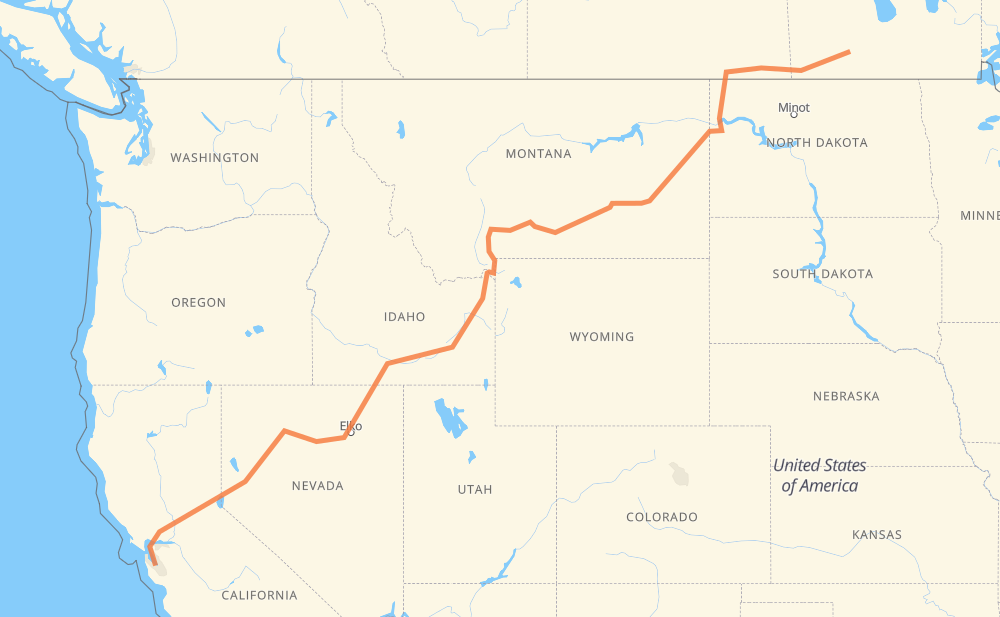
The distance from Stockton to East Palo Alto is 2,907 kilometers by road including 1,806 kilometers on motorways. Road takes approximately 30 hours and 9 minutes and goes through Estevan, Williston, Billings, Bozeman, Idaho Falls, Pocatello and Twin Falls.
| Shortest distance by air | 2,258 km ✈️ |
| Car route length | 2,907 km 🚗 |
| Driving time | 30 h 9 min |
| Fuel amount | 232.5 L |
| Fuel cost | 327.9 CAD |
| Point | Distance | Time | Fuel | |
| Stockton | 0 km | 00 min | 0.0 L | |
|
PTH 2 18 314 km, 3 h 36 min
|
||||
| Estevan | 314 km | 3 h 36 min | 24.1 L | |
|
18 US 85 148 km, 1 h 40 min
|
||||
| Williston | 463 km | 5 h 17 min | 36.3 L | |
|
US 2 I 94 526 km, 5 h 37 min
|
||||
| Billings | 989 km | 10 h 55 min | 78.4 L | |
|
I 90 228 km, 2 h 06 min
|
||||
| Bozeman | 1,217 km | 13 h 02 min | 97.2 L | |
|
I 90 Business US 20 315 km, 3 h 36 min
|
||||
| Idaho Falls | 1,532 km | 16 h 38 min | 122.1 L | |
|
US 20 I 15 79 km, 50 min
|
||||
| Pocatello | 1,611 km | 17 h 29 min | 127.7 L | |
|
I 86 US 30 176 km, 1 h 41 min
|
||||
| Twin Falls | 1,787 km | 19 h 10 min | 142.5 L | |
|
US 30 I 80 729 km, 7 h 09 min
|
||||
| Reno | 2,516 km | 26 h 20 min | 201.2 L | |
|
I 80 207 km, 1 h 58 min
|
||||
| Sacramento | 2,724 km | 28 h 19 min | 217.3 L | |
|
I 80 74 km, 42 min
|
||||
| Fairfield | 2,798 km | 29 h 02 min | 223.2 L | |
|
I 80 17 km, 09 min
|
||||
| Vallejo | 2,815 km | 29 h 11 min | 224.5 L | |
|
I 80 24 km, 14 min
|
||||
| Richmond | 2,839 km | 29 h 26 min | 226.7 L | |
|
I 80 9 km, 05 min
|
||||
| Berkeley | 2,849 km | 29 h 31 min | 227.7 L | |
|
I 80 12 km, 08 min
|
||||
| Oakland | 2,861 km | 29 h 39 min | 228.2 L | |
|
I 880 35 km, 21 min
|
||||
| Fremont | 2,896 km | 30 h 01 min | 231.1 L | |
|
CA 84 11 km, 08 min
|
||||
| East Palo Alto | 2,907 km | 30 h 10 min | 232.5 L | |
Hotels of East Palo Alto
Frequently Asked Questions
How much does it cost to drive from Stockton to East Palo Alto?
Fuel cost: 327.9 CAD
This fuel cost is calculated as: (Route length 2,907 km / 100 km) * (Fuel consumption 8.00 L/100 km) * (Fuel price 1.41 CAD / L)
You can adjust fuel consumption and fuel price here.
How long is a car ride from Stockton to East Palo Alto?
Driving time: 30 h 9 min
This time is calculated for driving at the maximum permitted speed, taking into account traffic rules restrictions.
- 894 km with a maximum speed 110 km/h = 8 h 7 min
- 423 km with a maximum speed 105 km/h = 4 h 2 min
- 351 km with a maximum speed 100 km/h = 3 h 30 min
- 757 km with a maximum speed 90 km/h = 8 h 24 min
- 69 km with a maximum speed 89 km/h = 46 min
- 385 km with a maximum speed 80 km/h = 4 h 48 min
- 10 km with a maximum speed 72 km/h = 8 min
- 5 km with a maximum speed 64 km/h = 4 min
- 2 km with a maximum speed 56 km/h = 2 min
- 6 km with a maximum speed 50 km/h = 7 min
- 2 km with a maximum speed 40 km/h = 3 min
- 2 km with a maximum speed 40 km/h = 2 min
The calculated driving time does not take into account intermediate stops and traffic jams.
How far is Stockton to East Palo Alto by land?
The distance between Stockton and East Palo Alto is 2,907 km by road including 1,806 km on motorways.
Precise satellite coordinates of highways were used for this calculation. The start and finish points are the centers of Stockton and East Palo Alto respectively.
How far is Stockton to East Palo Alto by plane?
The shortest distance (air line, as the crow flies) between Stockton and East Palo Alto is 2,258 km.
This distance is calculated using the Haversine formula as a great-circle distance between two points on the surface of a sphere. The start and finish points are the centers of Stockton and East Palo Alto respectively. Actual distance between airports may be different.
How many hours is Stockton from East Palo Alto by plane?
Boeing 737 airliner needs 2 h 49 min to cover the distance of 2,258 km at a cruising speed of 800 km/h.
Small plane "Cessna 172" needs 10 h 15 min to flight this distance at average speed of 220 km/h.
This time is approximate and do not take into account takeoff and landing times, airport location and other real world factors.
How long is a helicopter ride from Stockton to East Palo Alto?
Fast helicopter "Eurocopter AS350" or "Hughes OH-6 Cayuse" need 9 h 24 min to cover the distance of 2,258 km at a cruising speed of 240 km/h.
Popular "Robinson R44" needs 10 h 45 min to flight this distance at average speed of 210 km/h.
This time is approximate and do not take into account takeoff and landing times, aerodrome location and other real world factors.
What city is halfway between Stockton and East Palo Alto?
The halfway point between Stockton and East Palo Alto is Ashton. It is located about 2 km from the exact midpoint by road.
The distance from Ashton to Stockton is 1,451 km and driving will take about 15 h 41 min. The road between Ashton and East Palo Alto has length 1,456 km and will take approximately 14 h 28 min.
The other cities located close to halfway point:
Where is Stockton in relation to East Palo Alto?
Stockton is located 2,258 km north-east of East Palo Alto.
Stockton has geographic coordinates: latitude 49.58333, longitude -99.45.
East Palo Alto has geographic coordinates: latitude 37.46882, longitude -122.14108.
Which highway goes from Stockton to East Palo Alto?
The route from Stockton to East Palo Alto follows I 80, I 94, I 90, US 191, US 20, US 93, 18, US 95, US 30, US 85, I 86.
Other minor sections pass along the road:
- MT 16: 83 km
- US 12: 76 km
- I 15: 75 km
- I 84: 62 km
- US 95 ALT: 55 km
- PTH 2: 38 km
- US 26: 37 km
- PTH 23: 36 km
- PTH 3: 35 km
- US 212: 34 km
- I 880: 34 km
- PR 345: 33 km
- ND 200: 30 km
- PTH 83: 29 km
- US 2: 28 km
- MT 200: 19 km
- PTH 10: 17 km
- 350: 16 km
- CA 84: 13 km
- US 89: 11 km
- ID 25: 10 km
- ND 42: 10 km
- MT 84: 10 km
- ID 74: 10 km
- ND 5: 10 km
- I 580: 8 km
- ID 50: 8 km
- US 191 US 287: 7 km
- CA 113: 6 km
- US 287: 6 km
- 39: 6 km
- PTH 21: 5 km
- ND 1804: 5 km
- US 87: 4 km
- CA 12: 4 km
- MT 200: 4 km
- 39A: 3 km
- I 980: 3 km
- CA 89: 2 km
- I 90 Business: 2 km
- 9: 2 km
- CA 109: 1 km