Distance between Gypsumville MB and Fort Fraser BC
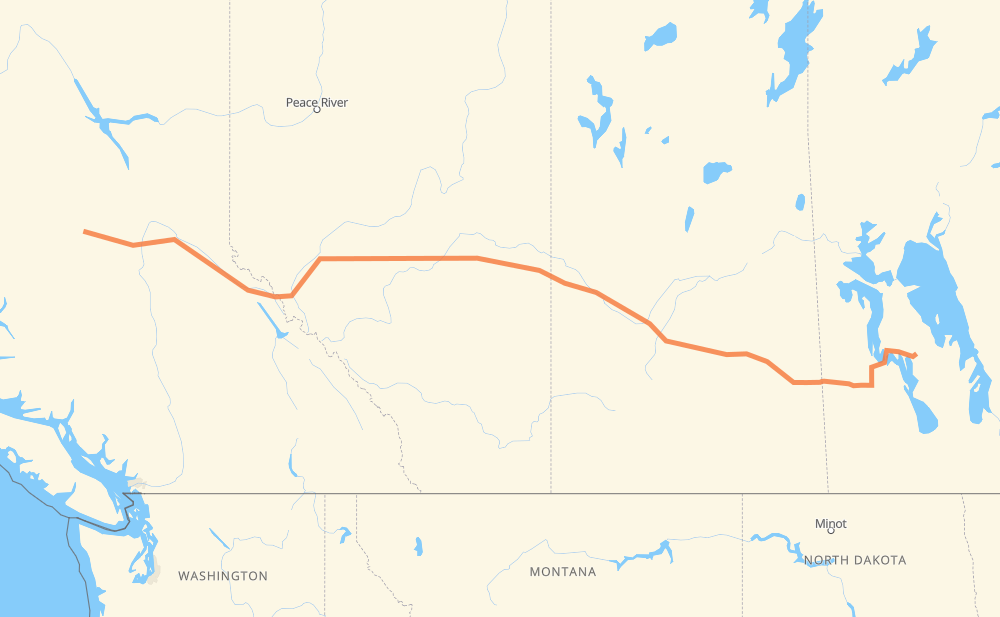
The distance from Gypsumville to Fort Fraser is 2,078 kilometers by road including 75 kilometers on motorways. Road takes approximately 36 hours and 54 minutes and goes through Dauphin, Yorkton, Saskatoon, North Battleford, Lloydminster, Edmonton and Spruce Grove.
| Shortest distance by air | 1,748 km ✈️ |
| Car route length | 2,078 km 🚗 |
| Driving time | 36 h 54 min |
| Fuel amount | 611 L |
| Fuel cost | 4,485 CAD |
| Point | Distance | Time | Fuel | |
| Gypsumville | 0 km | 00 min | 0.0 L | |
|
PR 513 PR 328 184 km, 3 h 17 min
|
||||
| Dauphin | 184 km | 3 h 17 min | 53.4 L | |
|
PTH 10A PTH 5 171 km, 3 h 02 min
|
||||
| Yorkton | 355 km | 6 h 20 min | 101.4 L | |
|
10 16 329 km, 5 h 50 min
|
||||
| Saskatoon | 684 km | 12 h 11 min | 199.1 L | |
|
11 16 161 km, 2 h 50 min
|
||||
| North Battleford | 845 km | 15 h 01 min | 240.4 L | |
|
16 109 km, 1 h 56 min
|
||||
| Lloydminster | 954 km | 16 h 58 min | 272.3 L | |
|
16 254 km, 4 h 29 min
|
||||
| Edmonton | 1,208 km | 21 h 27 min | 351.5 L | |
|
16 27 km, 24 min
|
||||
| Spruce Grove | 1,236 km | 21 h 52 min | 361.2 L | |
|
16 709 km, 12 h 37 min
|
||||
| Prince George | 1,944 km | 34 h 30 min | 567.8 L | |
|
16 134 km, 2 h 23 min
|
||||
| Fort Fraser | 2,078 km | 36 h 54 min | 610.5 L | |
Frequently Asked Questions
How much does it cost to drive from Gypsumville to Fort Fraser?
Fuel cost: 4,485 CAD
This fuel cost is calculated as: (Route length 2,078 km / 100 km) * (Fuel consumption 29.40 L/100 km) * (Fuel price 7.34 CAD / L)
You can adjust fuel consumption and fuel price here.
How long is a car ride from Gypsumville to Fort Fraser?
Driving time: 36 h 54 min
This time is calculated for driving at the maximum permitted speed, taking into account traffic rules restrictions.
- 75 km with a maximum speed 68 km/h = 1 h 6 min
- 1,989 km with a maximum speed 56 km/h = 35 h 31 min
- 14 km with a maximum speed 50 km/h = 17 min
The calculated driving time does not take into account intermediate stops and traffic jams.
How far is Gypsumville to Fort Fraser by land?
The distance between Gypsumville and Fort Fraser is 2,078 km by road including 75 km on motorways.
Precise satellite coordinates of highways were used for this calculation. The start and finish points are the centers of Gypsumville and Fort Fraser respectively.
How far is Gypsumville to Fort Fraser by plane?
The shortest distance (air line, as the crow flies) between Gypsumville and Fort Fraser is 1,748 km.
This distance is calculated using the Haversine formula as a great-circle distance between two points on the surface of a sphere. The start and finish points are the centers of Gypsumville and Fort Fraser respectively. Actual distance between airports may be different.
How many hours is Gypsumville from Fort Fraser by plane?
Boeing 737 airliner needs 2 h 11 min to cover the distance of 1,748 km at a cruising speed of 800 km/h.
Small plane "Cessna 172" needs 7 h 56 min to flight this distance at average speed of 220 km/h.
This time is approximate and do not take into account takeoff and landing times, airport location and other real world factors.
How long is a helicopter ride from Gypsumville to Fort Fraser?
Fast helicopter "Eurocopter AS350" or "Hughes OH-6 Cayuse" need 7 h 17 min to cover the distance of 1,748 km at a cruising speed of 240 km/h.
Popular "Robinson R44" needs 8 h 19 min to flight this distance at average speed of 210 km/h.
This time is approximate and do not take into account takeoff and landing times, aerodrome location and other real world factors.
What city is halfway between Gypsumville and Fort Fraser?
The halfway point between Gypsumville and Fort Fraser is Mannville. It is located about 4 km from the exact midpoint by road.
The distance from Mannville to Gypsumville is 1,043 km and driving will take about 18 h 34 min. The road between Mannville and Fort Fraser has length 1,035 km and will take approximately 18 h 20 min.
The other cities located close to halfway point:
Where is Gypsumville in relation to Fort Fraser?
Gypsumville is located 1,748 km east of Fort Fraser.
Gypsumville has geographic coordinates: latitude 51.76667, longitude -98.61667.
Fort Fraser has geographic coordinates: latitude 54.06664, longitude -124.55612.
Which highway goes from Gypsumville to Fort Fraser?
The route from Gypsumville to Fort Fraser follows 16, PTH 5.
Other minor sections pass along the road:
- 10: 64 km
- PR 328: 63 km
- PTH 20: 39 km
- PR 269: 29 km
- PR 276: 25 km
- 8: 20 km
- PTH 10: 15 km
- 11: 12 km
- 269: 11 km
- PR 513: 11 km
- 20: 10 km
- 22: 8 km
- 2: 7 km
- 40: 7 km
- PR 364: 6 km
- 6: 5 km
- 637: 5 km
- 674: 5 km
- 21: 3 km
- PTH 6: 3 km
- PTH 5A: 3 km
- PTH 10A: 3 km
- PTH 20A: 3 km
- 12: 2 km
- 9: 2 km
- 675: 1 km
- 4: 1 km