Distance between Canton de Gore QC and St. Eustache MB
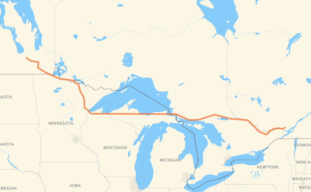
The distance from Canton de Gore to St. Eustache is 2,288 kilometers by road including 282 kilometers on motorways. Road takes approximately 40 hours and 2 minutes and goes through Gatineau, Ottawa, Pembroke, North Bay, Sault Ste. Marie, Marquette and Duluth.
| Shortest distance by air | 1,809 km ✈️ |
| Car route length | 2,288 km 🚗 |
| Driving time | 40 h 2 min |
| Fuel amount | 672.8 L |
| Fuel cost | 4,864.3 CAD |
| Point | Distance | Time | Fuel | |
| Canton de Gore | 0 km | 00 min | 0.0 L | |
|
329 50 123 km, 1 h 53 min
|
||||
| Gatineau | 123 km | 1 h 53 min | 30.3 L | |
|
50 52 km, 46 min
|
||||
| Ottawa | 175 km | 2 h 39 min | 42.1 L | |
|
417 17 111 km, 1 h 51 min
|
||||
| Pembroke | 286 km | 4 h 31 min | 82.9 L | |
|
17 205 km, 3 h 40 min
|
||||
| North Bay | 491 km | 8 h 11 min | 140.5 L | |
|
17 442 km, 7 h 47 min
|
||||
| Sault Ste. Marie | 933 km | 15 h 59 min | 272.7 L | |
|
17 M 28 267 km, 4 h 44 min
|
||||
| Marquette | 1,201 km | 20 h 43 min | 351.7 L | |
|
US 41 M 28 409 km, 7 h 15 min
|
||||
| Duluth | 1,609 km | 27 h 58 min | 470.2 L | |
|
US 53 262 km, 4 h 40 min
|
||||
| International Falls | 1,871 km | 32 h 38 min | 548.2 L | |
|
US 53 PTH 12 294 km, 5 h 15 min
|
||||
| Steinbach | 2,165 km | 37 h 54 min | 633.7 L | |
|
PTH 12 PTH 1 72 km, 1 h 15 min
|
||||
| Winnipeg | 2,238 km | 39 h 09 min | 653.2 L | |
|
PTH 100 PTH 1 61 km, 1 h 03 min
|
||||
| St. Eustache | 2,299 km | 40 h 12 min | 675.7 L | |
Frequently Asked Questions
How much does it cost to drive from Canton de Gore to St. Eustache?
Fuel cost: 4,864.3 CAD
This fuel cost is calculated as: (Route length 2,288 km / 100 km) * (Fuel consumption 29.40 L/100 km) * (Fuel price 7.23 CAD / L)
You can adjust fuel consumption and fuel price here.
How long is a car ride from Canton de Gore to St. Eustache?
Driving time: 40 h 2 min
This time is calculated for driving at the maximum permitted speed, taking into account traffic rules restrictions.
- 281 km with a maximum speed 68 km/h = 4 h 8 min
- 1,984 km with a maximum speed 56 km/h = 35 h 25 min
- 16 km with a maximum speed 50 km/h = 19 min
- 6 km with a maximum speed 48 km/h = 7 min
- 1 km with a maximum speed 40 km/h = 1 min
The calculated driving time does not take into account intermediate stops and traffic jams.
How far is Canton de Gore to St. Eustache by land?
The distance between Canton de Gore and St. Eustache is 2,288 km by road including 282 km on motorways.
Precise satellite coordinates of highways were used for this calculation. The start and finish points are the centers of Canton de Gore and St. Eustache respectively.
How far is Canton de Gore to St. Eustache by plane?
The shortest distance (air line, as the crow flies) between Canton de Gore and St. Eustache is 1,809 km.
This distance is calculated using the Haversine formula as a great-circle distance between two points on the surface of a sphere. The start and finish points are the centers of Canton de Gore and St. Eustache respectively. Actual distance between airports may be different.
How many hours is Canton de Gore from St. Eustache by plane?
Boeing 737 airliner needs 2 h 15 min to cover the distance of 1,809 km at a cruising speed of 800 km/h.
Small plane "Cessna 172" needs 8 h 13 min to flight this distance at average speed of 220 km/h.
This time is approximate and do not take into account takeoff and landing times, airport location and other real world factors.
How long is a helicopter ride from Canton de Gore to St. Eustache?
Fast helicopter "Eurocopter AS350" or "Hughes OH-6 Cayuse" need 7 h 32 min to cover the distance of 1,809 km at a cruising speed of 240 km/h.
Popular "Robinson R44" needs 8 h 36 min to flight this distance at average speed of 210 km/h.
This time is approximate and do not take into account takeoff and landing times, aerodrome location and other real world factors.
What city is halfway between Canton de Gore and St. Eustache?
The halfway point between Canton de Gore and St. Eustache is Christmas. It is located about 4 km from the exact midpoint by road.
The distance from Christmas to Canton de Gore is 1,140 km and driving will take about 19 h 37 min. The road between Christmas and St. Eustache has length 1,148 km and will take approximately 20 h 24 min.
The other cities located close to halfway point:
Where is Canton de Gore in relation to St. Eustache?
Canton de Gore is located 1,809 km east of St. Eustache.
Canton de Gore has geographic coordinates: latitude 45.75219, longitude -74.25392.
St. Eustache has geographic coordinates: latitude 49.97506, longitude -97.78081.
Which highway goes from Canton de Gore to St. Eustache?
The route from Canton de Gore to St. Eustache follows 17, M 28, US 53, US 2, PTH 12, 50.
Other minor sections pass along the road:
- 11: 96 km
- US 41: 95 km
- 417: 71 km
- MN 11: 60 km
- PTH 1: 53 km
- 71: 40 km
- PTH 100: 35 km
- 64: 16 km
- M 94: 15 km
- I 75: 15 km
- 329: 13 km
- 148: 12 km
- MN 194: 10 km
- MN 313: 9 km
- PR 248: 7 km
- US 53-MN 1: 7 km
- US 141: 7 km
- M 64: 7 km
- MN 37: 6 km
- WI 13: 6 km
- PR 241: 4 km
- MN 1: 4 km
- I 535: 4 km
- PR 311: 3 km
- 158: 3 km
- PR 427: 2 km
- PR 206: 2 km
- 611: 2 km
- PR 334: 2 km
- MN 72: 1 km